

Madison County boundary evolution
Map of, showing the evolution of the couunty's boundaries
- Date
- 1932
- Mapmaker / publisher
- Alabama State Planning Commission
- Place
- North America
- Archive
- Wikimedia Commons
- Type
- map
- Original size
- 2,163 × 2,290 pixels
Public domainsafest
Reason: published in the US without a copyright notice (before 1978).
Read from: Commons licence category: PD US no notice; no CC BY, CC BY-SA, GFDL or deletion tag on the file page.
Credit line
"Madison County boundary evolution" (1932). Alabama State Planning Commission, via Wikimedia Commons. Public domain. https://commons.wikimedia.org/wiki/File:Madison_County_boundary_evolution.jpegNeed maps for a whole project? Add Find Any Map to Claude and ask for this one by its id: 294270.
More like this

Map of Madison county, Alabama
1875 · Library of Congress

Map of Madison County, Texas.
1879 · Library of Congress
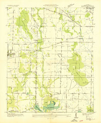
Madison, Alabama: USGS topographic map, 1:24,000 (1936–1975)
1936–1975 · 10 editions

Map of Madison County, Tenn. - from actual surveys and official records
1877 · Library of Congress

Soil map, Alabama, Washington County sheet
1915 · Library of Congress

Map of Colbert County, Alabama
1896 · Library of Congress

Map of Madison County, Va.
1860 · Library of Congress

Map of Alabama
1820 · Library of Congress