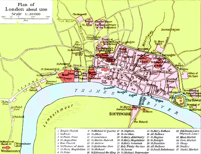

London 1300 Historical Atlas William R Shepherd (died 1934)
- Date
- 1300
- Place
- London
- Archive
- Wikimedia Commons
- Type
- atlas page
- Original size
- 700 × 536 pixels
Public domain
Reason: its maker died long enough ago that the copyright has expired.
This status rests on the map's publication history, as researched by Wikimedia Commons. Check it before commercial use.
Read from: Commons licence category: PD Old; no CC BY, CC BY-SA, GFDL or deletion tag on the file page.
Credit line
"London 1300 Historical Atlas William R Shepherd (died 1934)" (1300). Wikimedia Commons. Public domain. https://commons.wikimedia.org/wiki/File:London_1300_Historical_Atlas_William_R_Shepherd_(died_1934).PNGNeed maps for a whole project? Add Find Any Map to Claude and ask for this one by its id: 292051.
More like this

The British Isles about 1300
1926 · Wikimedia Commons

C. 1300 British Isles
c. 1911 · Wikimedia Commons

ONL (1887) 1.013 - Part of Modern London, Showing the Ancient Wall (map)
1873–1887 · Wikimedia Commons

London - Richard Blome's map of 1673
1673 · Wikimedia Commons

Cripplegate and neighbourhood, (from Agga's map)
1873–1887 · Wikimedia Commons

England wales 1832
1923 · Wikimedia Commons

A New and Plaine Mapp of the Citty of London.
1676 · BM Heal,Topography.186

Britannica London 2
1911 · Map of London