

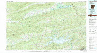
Lake Ouachita
Relief shown by hachures. Title from panel. Includes text, distance table, location map, and list of coordinates to boat ramps. Text, list to important phone numbers, and color illustrations on verso.
- Date
- 2015
- Mapmaker / publisher
- United States. Army. Corps Of Engineers. Vicksburg District
- Place
- Arkansas
- Archive
- Library of Congress (via Wikimedia Commons)
- Type
- map
- Original size
- 11,851 × 8,217 pixels
Public domainsafest
Reason: a US government work.
Read from: Commons licence category: PD US Government; no CC BY, CC BY-SA, GFDL or deletion tag on the file page.
Credit line
"Lake Ouachita" (2015). United States. Army. Corps Of Engineers. Vicksburg District. Library of Congress, Geography and Map Division, via Wikimedia Commons. Public domain. https://commons.wikimedia.org/wiki/File:Lake_Ouachita_LOC_2017590245.jpgNeed maps for a whole project? Add Find Any Map to Claude and ask for this one by its id: 14708.
More like this

Falls Lake, Neuse River, North Carolina
2012 · Library of Congress

B. Everett Jordan Dam and Lake, North Carolina
2012 · Library of Congress
Lake Ouachita, Arkansas: USGS topographic map, 1:100,000 (1982)
1982 · USGS Historical Topographic Map Collection

John H. Kerr Dam & Reservoir, Virginia and North Carolina
1992 · Library of Congress

John H. Kerr Dam and Reservoir - also known as Buggs Island Lake
2011 · Library of Congress

Chickasaw National Recreation Area
2011 · Library of Congress

Youghiogheny River Lake
1995 · Library of Congress

Chickasaw National Recreation Area
2010 · Library of Congress