

Kwantung-territoriet Kina 1921
- Date
- 1921
- Mapmaker / publisher
- en:User:Brionies, ändrad av:sv:Användare:Idrougge
- Place
- the Kwantung Leased Territory
- Archive
- Wikimedia Commons
- Type
- map
- Original size
- 563 × 498 pixels
Public domain
Reason: public domain: self.
This status rests on the map's publication history, as researched by Wikimedia Commons. Check it before commercial use.
Read from: Commons licence category: PD-self; no CC BY, CC BY-SA, GFDL or deletion tag on the file page.
Credit line
"Kwantung-territoriet Kina 1921" (1921). en:User:Brionies, ändrad av:sv:Användare:Idrougge, via Wikimedia Commons. Public domain. https://commons.wikimedia.org/wiki/File:Kwantung-territoriet_Kina_1921.pngNeed maps for a whole project? Add Find Any Map to Claude and ask for this one by its id: 24534.
More like this
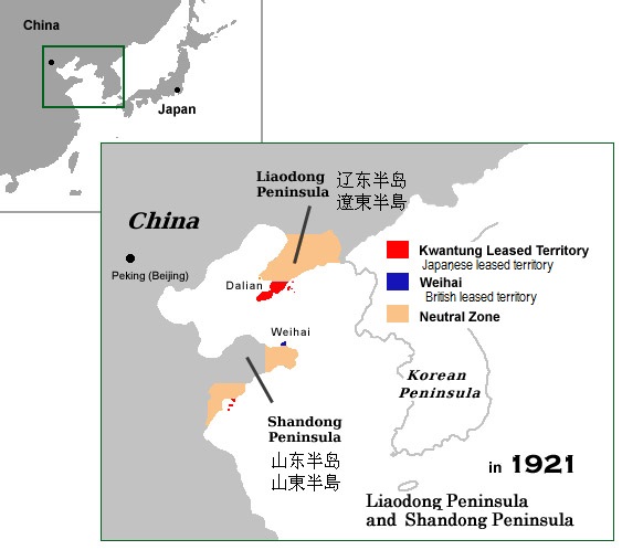
Kwantung territory China 1921
December 30, 2006 · Wikimedia Commons

Territory Leased to Russia (1898) and subsequently transferred to Japan (1905) in the Liaotung Peninsula (including the neutral zone)
1898–1905 · Wikimedia Commons

The map of Kwantung Leased Territory
1936 · Wikimedia Commons

Deutsch-China (Flemming 1916)
1916 · Wikimedia Commons

TreatyOfSevres (corrected) zh t
June 17, 2008 · Wikimedia Commons

Manchuria 1945
1945 · Wikimedia Commons

"The Kingdome of China", one of the first English-language maps of China. Note generally correct outline of the Ming China, with many provinces labeled (Cantam/Guangdong, Quancii/Guangxi, Chequiam/Zhe
1626–1627 · Wikimedia Commons

Manchu State
December 7, 2010 · Wikimedia Commons