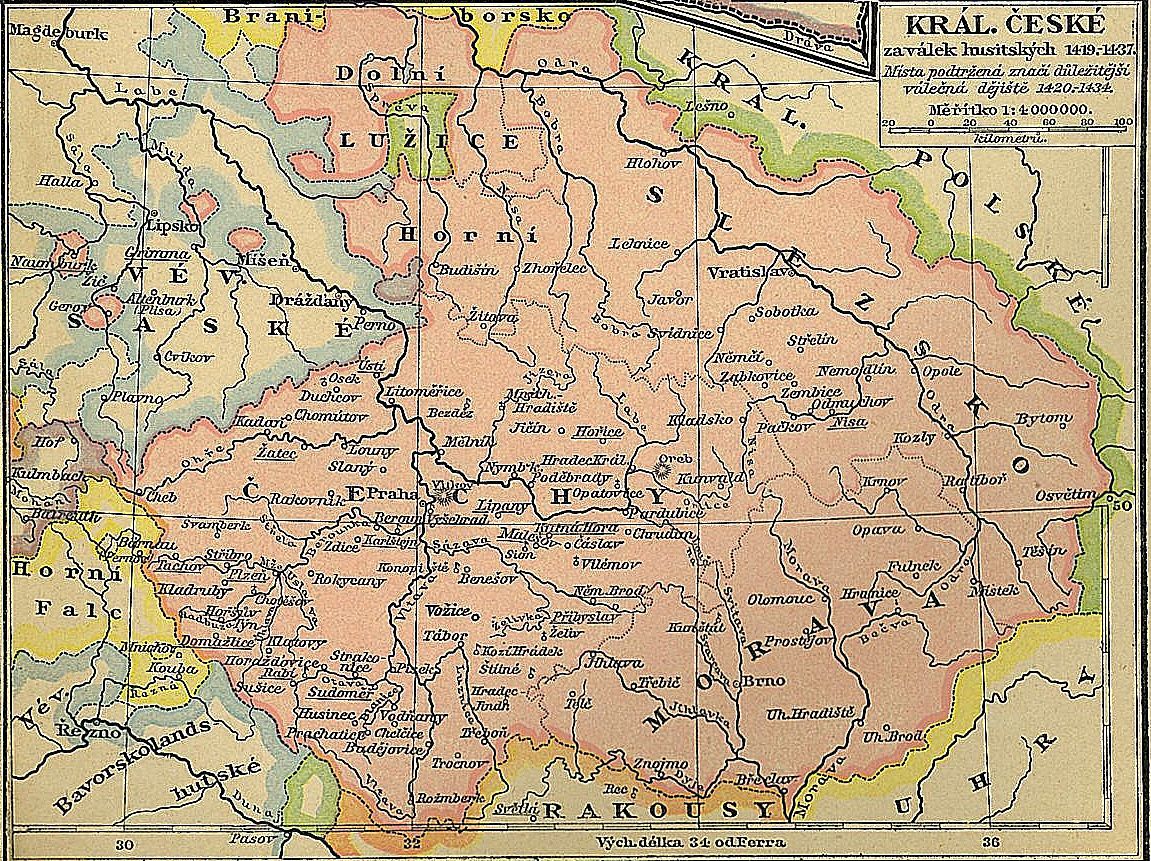

Kingdom of Bohemia during the Hussite Wars
Map of the Kingdom of Bohemia (the area in pink) at the time of the Hussite Wars. The descriptions are in Czech.
- Date
- 1898–1918
- Mapmaker / publisher
- Alfred Baldamus, Arnošt Schwab and Vavřinec Josef Dusek
- Place
- the Hussite Wars
- Archive
- Wikimedia Commons
- Type
- atlas page
- Original size
- 1,151 × 861 pixels
Public domainsafest
Reason: its maker died more than 70 years ago, and a faithful scan of a flat work adds no new copyright.
Read from: Commons licence category: PD-Art (PD-old-70); no CC BY, CC BY-SA, GFDL or deletion tag on the file page.
Credit line
"Kingdom of Bohemia during the Hussite Wars" (1898–1918). Alfred Baldamus, Arnošt Schwab and Vavřinec Josef Dusek, via Wikimedia Commons. Public domain. https://commons.wikimedia.org/wiki/File:Kingdom_of_Bohemia_during_the_Hussite_Wars.jpgNeed maps for a whole project? Add Find Any Map to Claude and ask for this one by its id: 19621.
More like this

Země Koruny české
1921 · Wikimedia Commons

Languages in Central Europe 1910
1910 · Wikimedia Commons

Rozsah české moci na počátku války třicetileté
1937 · Wikimedia Commons

F.W. Putzgers Historischer Schul-Atlas: zur alten, mittleren und neuen Geschichte: in 66 Haupt- und 63 Nebenkarten
Wikimedia Commons

Historická mapa - Čechy a Morava za zřízení župního ve XII století
1898 · Wikimedia Commons

Map for the Silesian and Seven Years Wars
1881 · 2 sheets

F. W. Putzgers Historischer Schul-Atlas: zur alten, mittleren und neuen Geschichte
Wikimedia Commons

Böhmen Mähren Österreich Schlesien
Wikimedia Commons