

Kalyan 1885
"Indian Empire," a Cram atlas map, 1885
- Date
- 1885
- Mapmaker / publisher
- Geo F Cram (Life time: 1885)
- Place
- India
- Archive
- Wikimedia Commons
- Type
- map
- Original size
- 1,692 × 2,340 pixels
Public domainsafest
Reason: its US copyright has expired (published before 1931).
Read from: Commons licence category: PD US expired; no CC BY, CC BY-SA, GFDL or deletion tag on the file page; permission field: Public domain.
Credit line
"Kalyan 1885" (1885). Geo F Cram (Life time: 1885), via Wikimedia Commons. Public domain. https://commons.wikimedia.org/wiki/File:Kalyan_1885.jpgNeed maps for a whole project? Add Find Any Map to Claude and ask for this one by its id: 241745.
More like this

Kalyan 1883
1883 · Wikimedia Commons

Kalyan 1861
1861 · Wikimedia Commons

The Indian Empire Map from Imperial Gazetteer of India,Vol 6, published 1886
1886 · Wikimedia Commons
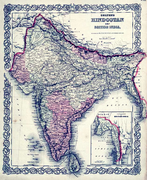
Map of British India, 1855. Published by G. W. and C. B. Colton and Company in New York, 1855. It was derived from an earlier wall map of the world produced by Colton and D. Griffing Johnson. Covers t
1855 · Wikimedia Commons

Map of British Raj
1894 · Wikimedia Commons

Hammond's Map of India, 1904
1904 · Wikimedia Commons

Imperial gazetteer of India.
1885 · Map of the Indian Empire

India or Hindostan.
1855 · Wikimedia Commons