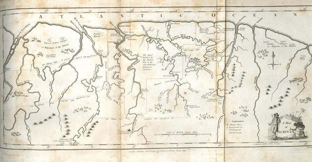

John Gabriel Stedman's original map of Surinam.
- Date
- 1796–2008
- Mapmaker / publisher
- Originally uploaded to Wikipedia by BrandonPeach 23:17, 1 May 2008 (UTC)
- Place
- Suriname
- Archive
- Wikimedia Commons
- Type
- map
- Original size
- 1,020 × 531 pixels
Public domain
Reason: its maker died more than 70 years ago.
This status rests on the map's publication history, as researched by Wikimedia Commons. Check it before commercial use.
Read from: Commons licence category: PD-old-70-expired; no CC BY, CC BY-SA, GFDL or deletion tag on the file page; permission field: PD Art--Copyright expired..
Credit line
"John Gabriel Stedman's original map of Surinam." (1796–2008). Originally uploaded to Wikipedia by BrandonPeach 23:17, 1 May 2008 (UTC), via Wikimedia Commons. Public domain. https://commons.wikimedia.org/wiki/File:Stedman1.jpgNeed maps for a whole project? Add Find Any Map to Claude and ask for this one by its id: 307079.
More like this

Narrative of a five years' expedition, against the revolted negroes of Surinam, in Guiana, on the wild coast of South America; from the year 1772, to 1777: elucidating the history of that country, and describing its productions. with an account of the Indians of Guiana, & negroes of Guinea Year
1806 · Wikimedia Commons

Narrative, of a five years' expedition, against the revolted negroes of Surinam, in Guiana, on the wild coast of South America, from the year 1772, to 1777: elucidating the history of that country, and describing its productions, viz, quadrupeds, birds, fishes, reptiles, trees, shrubs, fruits, & ro
1806 · Suriname

A map of Surinam, Barbutius; Cayenne in South America
1781 · Wikimedia Commons

Map of Surinam
c. 1770 · Wikimedia Commons

Map of the Colonies of Suriname and Berbice
1700–1799 · Wikimedia Commons

Algemene kaart van Suriname Algemeene kaart van de Colonie of Provintie van Suriname met de rivieren, districten, ontdekkingen door militaire togten en de grootte der gemeeten plantagien door last, op kosten, en met app, NG-478
1737–1757 · Wikimedia Commons

A Discription of the Coleny of Surranam in Guiana Drawne in the Yeare 1667
1667 · Wikimedia Commons