

Island of California
- Place
- California
- Archive
- Library of Congress (via Wikimedia Commons)
- Type
- map
- Original size
- 8,831 × 6,301 pixels
Public domain
Reason: its maker died more than 70 years ago.
This status rests on the map's publication history, as researched by Wikimedia Commons. Check it before commercial use.
Read from: Commons licence category: PD-old-70-expired; no CC BY, CC BY-SA, GFDL or deletion tag on the file page.
Credit line
"Island of California". Library of Congress, Geography and Map Division, via Wikimedia Commons. Public domain. https://commons.wikimedia.org/wiki/File:Island_of_California.jpgNeed maps for a whole project? Add Find Any Map to Claude and ask for this one by its id: 14133.
More like this

Map of California, 1684
1683–1719 · Wikimedia Commons

California
Wikimedia Commons

17th century world map - Nova Totius Terrarum Orbis Tabula
1670–1700 · Wikimedia Commons

Philippi Cluverii introductio in universam geographiam tam veterem, quam novam, multis locis emendata, memorabilibus locorum illustrata et tabulis geographicis aucta
2 sheets
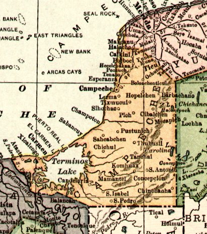
Campeche1910s
Wikimedia Commons

1632 Cardona Descripcion Indias
June 24, 1632 · Mexico

The isle of California, New Mexico, Louisiane, the river Misisipi, and the lakes of Canada.
1701 · New York Public Library

A new and correct Mapp of the WORLD; Atlases, gazetteers, guidebooks and other books / The sea-atlas: containing an hydrographical description of most of the sea-coasts of the known parts of the world
1702–1707 · New York Public Library