

Insularium Illustratum
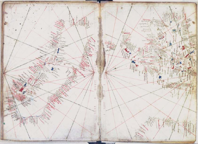
Additional MS 15760, ff.63v-64r
An account of the islands of the Mediterranean, and of some others, with coloured plans, and a few general maps
- Mapmaker / publisher
- date = 1495
- Place
- Italy
- Archive
- Wikimedia Commons
- Type
- map
- Original size
- 7,808 × 5,758 pixels
Public domain
Reason: its maker died long enough ago that the copyright has expired.
This status rests on the map's publication history, as researched by Wikimedia Commons. Check it before commercial use.
Read from: Commons licence category: PD Old; no CC BY, CC BY-SA, GFDL or deletion tag on the file page.
Credit line
"Insularium Illustratum". date = 1495, via Wikimedia Commons. Public domain. https://commons.wikimedia.org/wiki/File:Insularium_Illustratum_(Additional_MS_15760,_ff.63v-64r).jpegNeed maps for a whole project? Add Find Any Map to Claude and ask for this one by its id: 249784.
More like this

Cosmography (Cosmographia Claudii Ptolomaei Alexandrini)
1467 · Italy

Ptolemy's Cosmography (Cosmographia Claudii Ptolomaei Alexandrini)
1467 · Wikimedia Commons
Luxoro Atlas sheets 5 & 6
c. 1421 · Wikimedia Commons

Portolan atlas of 9 charts and a world map, etc. Dedicated to Hieronymus Ruffault, Abbot of St. Vaast
1544 · Europe, plate 8

Liber insularum Arcipelagi
Cotton MS Vespasian a.XIII.art.1, f.36v image

Listed in De Ricci, Seymour, Census of Medieval and Renaissance Manuscripts in the United States and Canada. New York. N.Y.: H.W. Wilson, 1935; and Supplement, New York, N.Y.: Bibliographical Society
1460 · New York Public Library

Atlas type Lafréri
1543–1577 · Italy, plate 111 of 226

Cosmographia (Sebastian Münster) p 099
1545 · Wikimedia Commons