

Indo-Greek map in color. Personal drawing 2007.
- Date
- January 10, 2007
- Place
- Shunga Empire
- Archive
- Wikimedia Commons
- Type
- map
- Original size
- 1,202 × 1,440 pixels
Public domain
Reason: public domain: self.
This status rests on the map's publication history, as researched by Wikimedia Commons. Check it before commercial use.
Read from: Commons licence category: PD-self; no CC BY, CC BY-SA, GFDL or deletion tag on the file page.
Credit line
"Indo-Greek map in color. Personal drawing 2007." (January 10, 2007). Wikimedia Commons. Public domain. https://commons.wikimedia.org/wiki/File:Indo-GreekMapColor.jpgNeed maps for a whole project? Add Find Any Map to Claude and ask for this one by its id: 256141.
More like this

Map of the Indo-Greeks. Source from Narain Coins of the Indo-Greeks and Westermann Grosser Atlas zur Weltgeschichte. Own work.
2007 · Wikimedia Commons

Sunga map
September 21, 2017 · Wikimedia Commons
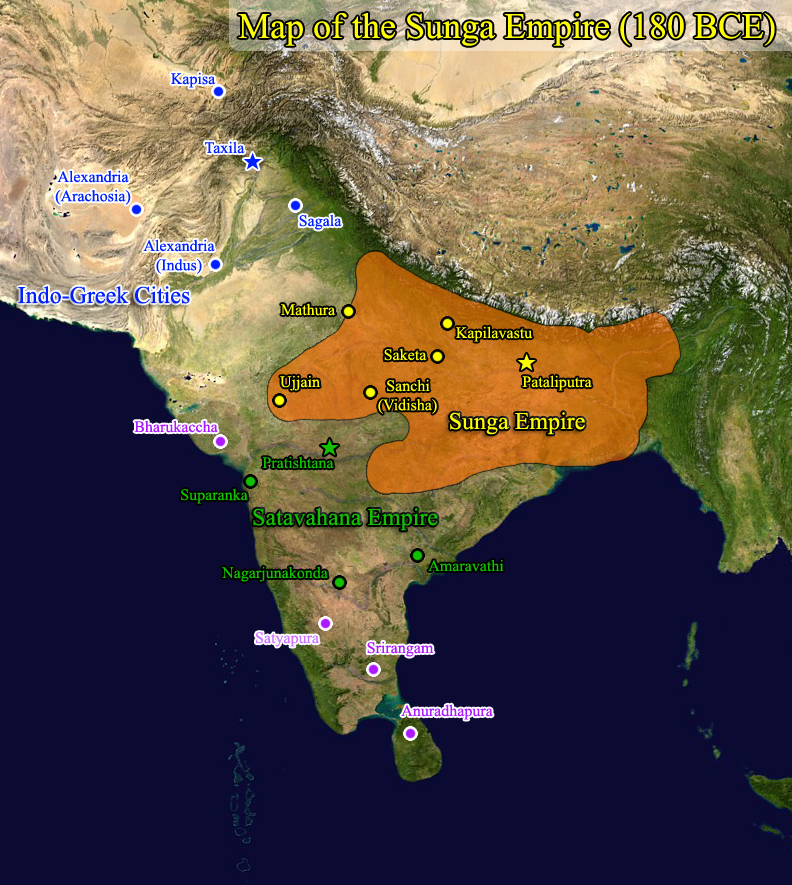
Map of the Sunga Empire based on Oxford University Atlas
2009 · Wikimedia Commons

Kushan Empire (highlighted)
1907 · Wikimedia Commons

The Empire of Asoka
1920 · Wikimedia Commons

Joppen 1907 India in the 2nd Century A.D
December 31, 1907 · Wikimedia Commons

Map of ancient India, as published in the Mahan Kosh
1930 · Wikimedia Commons

Tibetan nomads in the year 60 AD, Periplus World Map
1912 · Wikimedia Commons