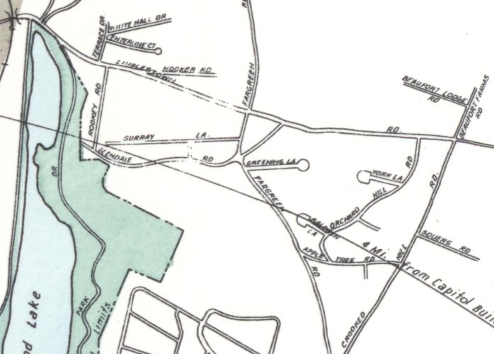

In 1956, this Sanborn Map shows the early streets created for the development of Beaufort Farms
- Date
- 1956
- Mapmaker / publisher
- Sanborn Map Company
- Archive
- Library of Congress (via Wikimedia Commons)
- Type
- map
- Original size
- 698 × 500 pixels
Public domain
Reason: a US government work.
This status rests on the map's publication history, as researched by Wikimedia Commons. Check it before commercial use.
Read from: Commons licence category: PD US Government; no CC BY, CC BY-SA, GFDL or deletion tag on the file page; Commons tags it as a US government work, but its record names no government maker.
Credit line
"In 1956, this Sanborn Map shows the early streets created for the development of Beaufort Farms" (1956). Sanborn Map Company. Library of Congress, Geography and Map Division, via Wikimedia Commons. Public domain. https://commons.wikimedia.org/wiki/File:EarlyBeafortFarmsDevelopment.pngNeed maps for a whole project? Add Find Any Map to Claude and ask for this one by its id: 121468.
More like this

Sanborn Fire Insurance Map from Steelton, Dauphin County, Pennsylvania, 1884
1884 · 6 sheets

Sanborn Fire Insurance Map from Harrisburg, Dauphin County, Pennsylvania, 1890, volume 2
1890 · 42 sheets

Sanborn Fire Insurance Map from Mechanicsburg, Cumberland County, Pennsylvania, 1896, volume 3
1896 · 8 sheets

Sanborn Fire Insurance Map from Steelton, Dauphin County, Pennsylvania, 1896, volume 3
1896 · 12 sheets

Sanborn Fire Insurance Map from Harrisburg, Dauphin County, Pennsylvania, 1884
1884 · 28 sheets

Sanborn Fire Insurance Map from Scranton Suburbs, Lackawanna County, Pennsylvania, 1893
1893 · 5 sheets

Sanborn Fire Insurance Map from Middletown, Dauphin County, Pennsylvania, 1896, volume 2
1896 · 9 sheets

Sanborn Fire Insurance Map from Dauphin, Dauphin County, Pennsylvania. sanborn07614 003
1890 · Library of Congress