

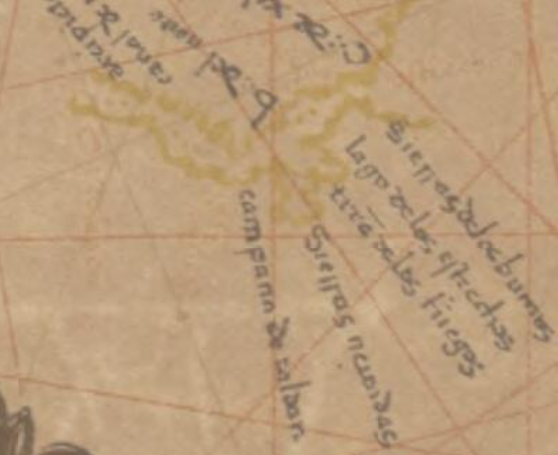
Illa de Xàtiva
. Part of a map by Diego Ramírez de Arellano that includes the toponym Isla de Xativa, nowadays Isla Grande de Tierra del Fuego.
- Date
- 1621
- Mapmaker / publisher
- Diego Ramírez de Arellano
- Place
- the Strait of Magellan
- Archive
- Wikimedia Commons
- Type
- map
- Original size
- 2,275 × 2,203 pixels
Public domain
Reason: its maker died long enough ago that the copyright has expired.
This status rests on the map's publication history, as researched by Wikimedia Commons. Check it before commercial use.
Read from: Commons licence category: PD Old; no CC BY, CC BY-SA, GFDL or deletion tag on the file page; permission field: Multi-license CC-BY-SA-3.0 and GFDL.
Credit line
"Illa de Xàtiva" (1621). Diego Ramírez de Arellano, via Wikimedia Commons. Public domain. https://commons.wikimedia.org/wiki/File:Illa_de_X%C3%A0tiva.jpgNeed maps for a whole project? Add Find Any Map to Claude and ask for this one by its id: 307112.
More like this

Illa de Xàtiva millorat
October 23, 2014 · Wikimedia Commons
Campana de Roldán
1529 · Wikimedia Commons

Mapa Marítimo del Estrecho de Magallanes. Juan de la Cruz Cano y Olmedilla, 1769
1769 · Wikimedia Commons

Primo viaggio intorno al globo terracqueo; ossia, Ragguaglio della navigazione alle Indie Orientali per la via d'Occidente / fatta dal cavaliere Antonio Pigafetta
c. 1520 · Wikimedia Commons

A new mapp of MAGELLAN STRAIGHTS discovered by Capt. John Narbourgh commander then of His Majesty's Ship Sweepstakes as he sayled through sade straights.; Atlases, gazetteers, guidebooks and other boo
1702–1707 · New York Public Library

TABVLA MAGELLANICA quà Tierrae del fuego, cum celeberrimus fretis a F. Magellano et I. Le Maire detectis novissima et accuratissima descriptio exhibetur
1635 · Wikimedia Commons

Stevenson 1911 atlasofportolanc00magg 0021 IX Western Mediterranean
December 31, 1911 · Wikimedia Commons

Plan du detroit du Maire dont l'entrée du côtté du nord qui est le Cap St. Iaque est situé par les 54. d. 30. ms. latt. sud.
1715 · Library of Congress