

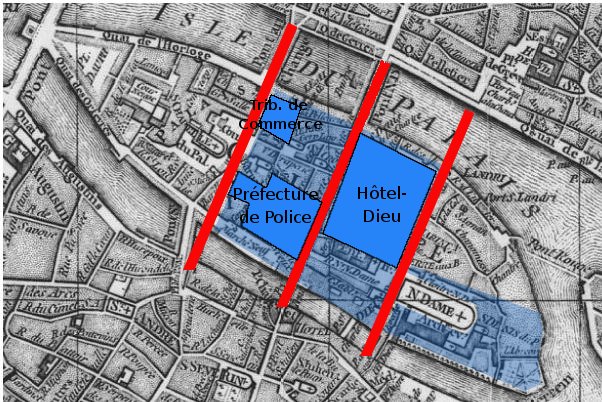
Île de la Cité, Île Saint-Louis
Île de la Cité and Île Saint-Louis
- Date
- April 12, 2009
- Mapmaker / publisher
- Paris 16
- Place
- Paris
- Archive
- Wikimedia Commons
- Type
- map
- Original size
- 2,100 × 1,300 pixels
Public domain
Reason: public domain: self.
This status rests on the map's publication history, as researched by Wikimedia Commons. Check it before commercial use.
Read from: Commons licence category: PD-self; no CC BY, CC BY-SA, GFDL or deletion tag on the file page; permission field: 200px.
Credit line
"Île de la Cité, Île Saint-Louis" (April 12, 2009). Paris 16, via Wikimedia Commons. Public domain. https://commons.wikimedia.org/wiki/File:%C3%8Ele_de_la_Cit%C3%A9,_%C3%8Ele_Saint-Louis.pngNeed maps for a whole project? Add Find Any Map to Claude and ask for this one by its id: 299078.
More like this

Île de la Cité
April 12, 2009 · Wikimedia Commons

Ile de la cite 1609
1609 · Wikimedia Commons

Île Louviers, Plan de Vassalieu ca. 1609
c. 1609 · Wikimedia Commons
Paris-cite-haussmann
Wikimedia Commons

Ile de la Cité - Scotin
1710–2017 · Wikimedia Commons

Ponts de l'ile de la Cité
1615 · Wikimedia Commons

Paris-cite-vaugondy-1771
1771 · Wikimedia Commons

{ class="wikitable unsortable" - ! Auteur(s): Attribué à Perrier (Ole), graveur Jaillot, Hubert, auteur du modèle - ! Autre titre: IVe arrondissement - Ile de la Cité (Ier et IVe arrondissement): plan
Wikimedia Commons