

Houston area test site- Land use map.
Scale ca. 1:500,000. "Transverse Mercator projection." "10,000 meter universal transverse mercator grid, zones 14 and 15." "Experimental map." "This map was prepared by Earth Observation Division personnel of the Manned Spacecraft Center, NASA, to assist in the study of applications of remote sensor technology to resource management and environmental problems in the Houston area. The land use was interpreted largely from 1:120,000 scale color ektachrome film taken in November, 1970." Includes key map. AACR2
- Date
- 1973
- Mapmaker / publisher
- United States. Earth Observations Programs Division
- Place
- Texas
- Scale
- 1:500,000
- Archive
- Library of Congress (via Wikimedia Commons)
- Type
- map
- Original size
- 7,020 × 9,125 pixels
Public domainsafest
Reason: a US government work.
Read from: Commons licence category: PD US Government; no CC BY, CC BY-SA, GFDL or deletion tag on the file page.
Credit line
"Houston area test site- Land use map." (1973). United States. Earth Observations Programs Division. Library of Congress, Geography and Map Division, via Wikimedia Commons. Public domain. https://commons.wikimedia.org/wiki/File:Houston_area_test_site-_Land_use_map._LOC_73696471.jpgNeed maps for a whole project? Add Find Any Map to Claude and ask for this one by its id: 11905.
More like this
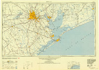
Houston, Texas: USGS topographic map, 1:250,000 (1950–1975)
1950–1975 · 5 editions

Air-crash search-and-rescue map. Hood Army Airfield (Fort Hood), Texas
1978 · Library of Congress

National atlas- Southern Texas.
1976 · Library of Congress

Land cover, southwest Georgia land and water resource cooperative study
1977 · Library of Congress

Transportation map of Texas (south).
1975 · Library of Congress

Transportation map of Texas (south).
1975 · Library of Congress

Land use of the Lafourche-Terrebonne cooperative river basin study, Lafourche and Terrebonne parishes, Louisiana
1985 · Library of Congress

Transportation map of Texas (north).
1975 · Library of Congress