

Honey Hill Battlefield South Carolina
Map of battlefield core and study areas. The ABPP revised the 1993 Study Area to include several misdirected routes used by US forces while attempting to locate and destroy the Charleston & Savannah Railroad near Grahamville. The ABPP included these routes as part of the Study Area because this activity exhausted Federal troops and delayed their arrival at Honey Hill, providing Confederate forces extra time to prepare for battle. The Confederate approach route from the railroad to the engagement area was also included in the Study Area. The ABPP expanded the Core Area’s southern boundary to include the Euhaw Creek causeway where Confederate forces bombarded Federal forces attempting to cross the creek. Along the northern edge, the ABPP reduced the Core Area to better represent the range of Federal artillery positioned along Wood Road.
- Date
- December 9, 2010
- Mapmaker / publisher
- American Battlefield Protection Program
- Archive
- Wikimedia Commons
- Type
- map
- Original size
- 1,060 × 810 pixels
Public domainsafest
Reason: a US government work.
Read from: Commons licence category: PD US Government; no CC BY, CC BY-SA, GFDL or deletion tag on the file page.
Credit line
"Honey Hill Battlefield South Carolina" (December 9, 2010). American Battlefield Protection Program, via Wikimedia Commons. Public domain. https://commons.wikimedia.org/wiki/File:Honey_Hill_Battlefield_South_Carolina.jpgNeed maps for a whole project? Add Find Any Map to Claude and ask for this one by its id: 1140.
More like this

Grimball's Landing Battlefield South Carolina
December 9, 2010 · Wikimedia Commons

Secessionville Battlefield South Carolina
December 9, 2010 · Wikimedia Commons

Simon's Bluff Battlefield South Carolina
December 9, 2010 · Wikimedia Commons

Rivers' Bridge Battlefield South Carolina
December 9, 2010 · Wikimedia Commons
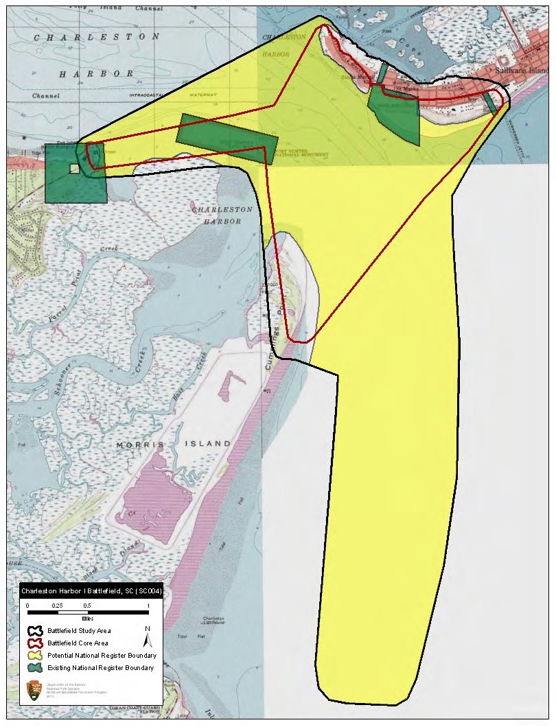
Charleston Harbor I Battlefield South Carolina
December 9, 2010 · Wikimedia Commons

Kock's Plantation Battlefield Louisiana
November 2, 2010 · Wikimedia Commons

Pleasant Hill Battlefield Louisiana
November 2, 2010 · Wikimedia Commons

Jonesborough Battlefield Georgia
June 23, 2010 · Wikimedia Commons