

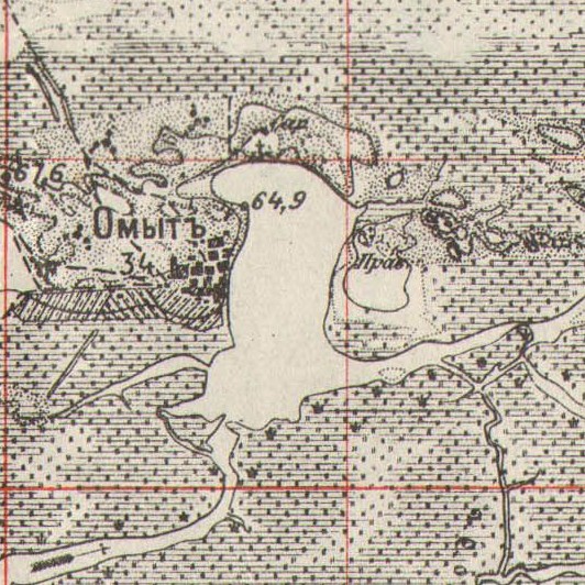
Hnyla Prypyat, 1898
Hnyla Prypyat River on the hydrographic map of Polissia, 1898.
- Date
- 1898
- Mapmaker / publisher
- Картографическое заведение А. Ильина
- Place
- the Russian Empire
- Archive
- Wikimedia Commons
- Type
- map
- Original size
- 838 × 800 pixels
Public domain
Reason: public domain: RusEmpire.
This status rests on the map's publication history, as researched by Wikimedia Commons. Check it before commercial use.
Read from: Commons licence category: PD-RusEmpire; no CC BY, CC BY-SA, GFDL or deletion tag on the file page.
Credit line
"Hnyla Prypyat, 1898" (1898). Картографическое заведение А. Ильина, via Wikimedia Commons. Public domain. https://commons.wikimedia.org/wiki/File:Hnyla_Prypyat,_1898.jpgNeed maps for a whole project? Add Find Any Map to Claude and ask for this one by its id: 242288.
More like this

Hydrographic map of Polissia, 1898
1898 · Wikimedia Commons

Hypsometric map of Polissia, 1898
1898 · Wikimedia Commons

Levelling map of Polissia, 1874
1874 · Wikimedia Commons

Geological map of Polissia, 1874
1874 · Wikimedia Commons

Volhynian Gov - part Wysock
1887 · Wikimedia Commons
Lake Omyt in Zarichne Raion, 1910
1910 · Wikimedia Commons

Lake Nobel on the map "Новая Топографическая Карта Западной России", XXIV 19, 1915
1915 · Wikimedia Commons

Lake Velyke in Zarichne Raion, 1910
1910 · Wikimedia Commons