

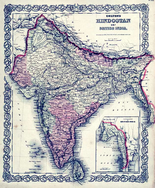
Hindostan or British India.
A beautiful 1855 first edition example of Colton's map of India. Covers the subcontinent from Tibet to Ceylon (Sri Lanka). Color coded according to region and divided into Bombay, Scinde, Punjab, Nepal, Bhutan, the Bengal Presidency, Madras and Ceylon. An inset map in the lower right quadrant shows British claims in Burma (Pegu) and Southeast Asia. Throughout, Colton identifies various cities, towns, rivers and assortment of additional topographical details. Surrounded by Colton's typical spiral motif border. Dated and copyrighted to J. H. Colton, 1855. Published from Colton's 172 William Street Office in New York City. Issued as page no. 30 in volume 2 of the first edition of George Washington Colton's 1855 Atlas of the World.
- Date
- 1855
- Place
- South Asia
- Archive
- Wikimedia Commons
- Type
- atlas page
- Original size
- 2,919 × 3,500 pixels
Public domainsafest
Reason: its maker died more than 100 years ago.
Read from: Commons licence category: PD-old-100-expired; no CC BY, CC BY-SA, GFDL or deletion tag on the file page.
Credit line
"Hindostan or British India." (1855). Wikimedia Commons. Public domain. https://commons.wikimedia.org/wiki/File:1855_Colton_Map_of_India_-_Geographicus_-_India-colton-1855.jpgNeed maps for a whole project? Add Find Any Map to Claude and ask for this one by its id: 256435.
More like this

India or Hindostan.
1855 · Wikimedia Commons
Map of British India, 1855. Published by G. W. and C. B. Colton and Company in New York, 1855. It was derived from an earlier wall map of the world produced by Colton and D. Griffing Johnson. Covers t
1855 · Wikimedia Commons

Johnson’s Hindostan or British India.
1864 · 1865 Johnson's Map of India Hindostan or British India

Johnson’s Hindostan or British India.
1864 · South Asia

Hindoustan ou Inde en deca du Gange et Inde Transgangetique par V. Levasseur Geographe.
1852 · Wikimedia Commons

British India John Tallis
1851 · Wikimedia Commons

1852 map of India by Thomas Cowperthwait & Co
1852 · Wikimedia Commons

Map of Hindoostan, Farther India, China, and Tibet.
1860 · Wikimedia Commons