

Henricus Martellus' World Map
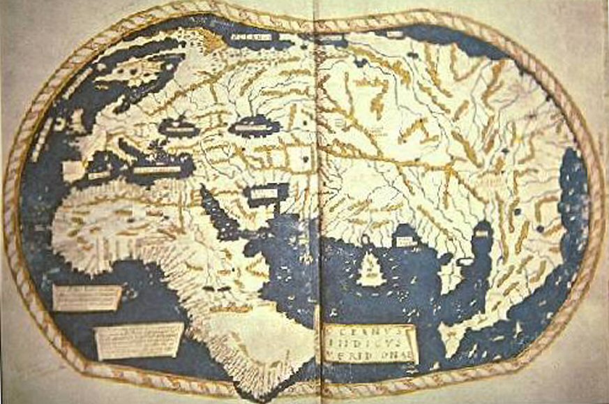
The world map of "Henricus Martellus Germanus" (Heinrich Hammer the German), Florence, c. 1489. 300 x 470 mm. The first map with the Dragon Tail. It is a mixture of Ptolemy, recent Portuguese discoveries and unknown sources. Displays the Cape of Good Hope, rounded by Bartolomeo Dias in 1488.
- Date
- 1490–1492
- Mapmaker / publisher
- Ptolemy (Κλαύδιος Πτολεμαῖος, Claudius Ptolemaeus)
- Archive
- Wikimedia Commons
- Type
- map
- Original size
- 600 × 432 pixels
Public domainsafest
Reason: its maker died more than 100 years ago, and a faithful scan of a flat work adds no new copyright.
Read from: Commons licence category: PD-Art (PD-old-100); no CC BY, CC BY-SA, GFDL or deletion tag on the file page.
Credit line
"Henricus Martellus' World Map" (1490–1492). Ptolemy (Κλαύδιος Πτολεμαῖος, Claudius Ptolemaeus), via Wikimedia Commons. Public domain. https://commons.wikimedia.org/wiki/File:Henricus_Martellus%27_World_Map.jpgNeed maps for a whole project? Add Find Any Map to Claude and ask for this one by its id: 20936.
More like this

Martellus World-Map
c. 1489 · Wikimedia Commons
Henricus Martellus Germanus (Wirkungsjahre 1480-1496)
1489 · Wikimedia Commons

World map by Martellus - Account of the Islands of the Mediterranean (1489), ff.68v-69 - BL Add MS 15760
1487 · Wikimedia Commons

The Yale world map of "Henricus Martellus Germanus" (Heinrich Hammer), probably from Florence 1490-92. It is the most detailed "Dragon Tail" map by Martellus. It is the only one with a coordinate grid
1490 · Wikimedia Commons

Henricus Martellus - Map of the world - 1489 - Yale archive
c. 1489 · Wikimedia Commons

Insularium Illustratum
Additional MS 15760, ff.68v-69r

The world map from Leinhart Holle's 1482 edition of Nicolaus Germanus's emendations to Jacobus Angelus's 1406 Latin translation of Maximus Planudes's late-13th century rediscovered Greek manuscripts o
1482 · Wikimedia Commons

World map RMG C4568 2
1508 · Wikimedia Commons