

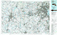
Helicopter route chart, Boston.
Aeronautical chart showing designated helicopter routes in Boston metropolitan area. "Includes airspace amendments effective August 10, 2000 and all other aeronautical data received by June 15, 2000." Relief shown by spot heights. Shows radial distances from Logan International Airport. Includes indexed directories of routes, notes, text, and statistical tables. Indexed directories of routes, metro-area map of "Boston downtown, scale 1:50,000," notes, text, and statistical tables on verso.
- Date
- 2000
- Mapmaker / publisher
- United States. National Ocean Service
- Place
- Massachusetts
- Scale
- 1:50,000
- Archive
- Library of Congress (via Wikimedia Commons)
- Type
- chart
- Original size
- 10,650 × 17,880 pixels
Public domainsafest
Reason: a US government work.
Read from: Commons licence category: PD US Government; no CC BY, CC BY-SA, GFDL or deletion tag on the file page.
Credit line
"Helicopter route chart, Boston." (2000). United States. National Ocean Service. Library of Congress, Geography and Map Division, via Wikimedia Commons. Public domain. https://commons.wikimedia.org/wiki/File:Helicopter_route_chart,_Boston._LOC_2001620358.jpgNeed maps for a whole project? Add Find Any Map to Claude and ask for this one by its id: 13628.
More like this

Helicopter route chart, Boston.
2007 · Library of Congress

Helicopter route chart, Washington, D.C.
1988 · Library of Congress

A chart of the harbour of Boston
1775 · Library of Congress

A Chart of the harbour of Boston, with the soundings, sailing-marks, and other directions.
1777 · Library of Congress
Boston, Massachusetts: USGS topographic map, 1:100,000 (1985–1989)
1985–1989 · 3 editions

Map of Boston and its vicinity
1820 · Library of Congress

Carte particulière du havre de Boston avec les sondes les bancs de Sable, les rochers les Amaies et les autres directions utiles à la navigation.
1780 · Library of Congress

Boston and environs.
1905 · Library of Congress