
Haiti 1-50,000.
Île-à-Vache
Geographic coverage complete in 81 sheets. Relief shown by contours and spot heights. Depths shown by contours and soundings on some sheets. English and French on some sheets. Earlier sheets prepared by Army Map Service; Defense Mapping Agency, Hydrographic/Topographic Center; and Defense Mapping Agency, Aerospace Center. Includes various editions of some sheets. Some sheets include index to adjoining sheets, indexed boundary diagram, coverage diagram, elevation guide diagram, and glossary.
- Date
- 1948
- Mapmaker / publisher
- United States. National Imagery And Mapping Agency; United States. Army Map Service; United States. Defense Mapping Agency. Hydrographic/Topographic Center; Aerospace Center (U.S.)
- Place
- Île-à-Vache
- Archive
- Library of Congress (via Wikimedia Commons)
- Type
- map
- Sheets
- 2
- Original size
- 11,374 × 8,571 pixels
Public domainsafest
Reason: a US government work.
Read from: Commons licence category: PD US Government; no CC BY, CC BY-SA, GFDL or deletion tag on the file page.
Credit line
"Haiti 1-50,000." (1948). United States. National Imagery And Mapping Agency; United States. Army Map Service; United States. Defense Mapping Agency. Hydrographic/Topographic Center; Aerospace Center (U.S.). Library of Congress, Geography and Map Division, via Wikimedia Commons. Public domain. https://commons.wikimedia.org/wiki/File:Haiti_1-50,000._LOC_00561886-20.jpgNeed maps for a whole project? Add Find Any Map to Claude and ask for this one by its id: 13529.
All 2 sheets
Each sheet links to its file at the archive; the image link is the full-size scan.


More like this

Haiti. 10-62.
1962 · Library of Congress

Plan de l'isle à Vache à la coste de sud de S. Domingue.
1764 · Library of Congress

Carte des bayes du Mesle, des Flamands, et de Cavaillon dans l'isle de St. Domingue.
1764 · Library of Congress

Environs de Léogâne et du Port au Prince dans l'isle de St. Domingue.
1764 · Library of Congress

La partie françoise de l'isle de Saint Domingue.
1764 · Library of Congress
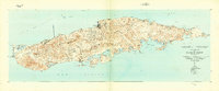
Island Of Vieques, Puerto Rico: USGS topographic map, 1:30,000 (1943–1951)
1943–1951 · 4 editions

Le Port au Prince dans l'isle de St. Domingue.
1764 · Library of Congress

Baye et ville de Bayaha ou Port-Dauphin dans l'isle de St. Domingue.
1764 · Library of Congress