

Gulf Coast Lines system map
Parker Engaving Co., St. Louis, Missouri, no date. Public domain because it was made during the life of the company (1916-Dec. 31, 1924), and must have been made before mid-1924 when the company acquired the International-Great Northern Railroad, not indicated at all on this map. So the likelihood is great that this was first created and published pre-1923; and in any case, no copyright notice is provided on the map. Found at Texas Transportation Archive ( accessed 2 April 2011.
- Date
- 1916
- Place
- the Gulf of Mexico
- Archive
- Wikimedia Commons
- Type
- map
- Original size
- 1,200 × 771 pixels
Public domain
Reason: a US government work.
This status rests on the map's publication history, as researched by Wikimedia Commons. Check it before commercial use.
Read from: Commons licence category: PD US; no CC BY, CC BY-SA, GFDL or deletion tag on the file page.
Credit line
"Gulf Coast Lines system map" (1916). Wikimedia Commons. Public domain. https://commons.wikimedia.org/wiki/File:Gulf_Coast_Lines_system_map.jpgNeed maps for a whole project? Add Find Any Map to Claude and ask for this one by its id: 295849.
More like this

Preliminary chart of the northwestern part of the Gulf of Mexico. Unfinished proof.
1861 · Library of Congress

Map of the Houston and Texas Central Railway. The New Avenue of Travel and Transportation Between the United States and Mexico
1880 · Rand

1893 Poor's Monterey and Mexican Gulf Railroad
1893 · Wikimedia Commons

1914 map of Central America
April 29, 1914 · Wikimedia Commons

Gulf coast of the United States; Key West to Rio Grande.
1863 · Library of Congress

I. & G.N., T.& P. - Iron Mountain - the way to Texas
1909 · Library of Congress
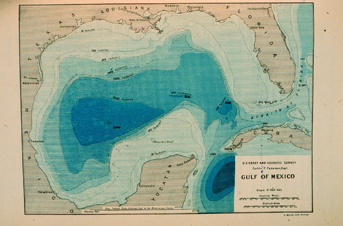
Contour map of Gulf of Mexico 1888
1888 · Wikimedia Commons

Map of the Gulf Coast from Florida to Mexico
1639 · Wikimedia Commons