

Greenwich Bay watershed
Shows surface and underground water supply, community wells, dense residential land use, commercial and industrial land use, agricultural land use, highly leachable soils, and soils with severe limitations for septic systems. Includes data sources and location map. "1007877."
- Date
- 1995
- Mapmaker / publisher
- United States. Natural Resources Conservation Service
- Place
- Rhode Island
- Archive
- Library of Congress (via Wikimedia Commons)
- Type
- map
- Original size
- 7,669 × 6,347 pixels
Public domainsafest
Reason: a US government work.
Read from: Commons licence category: PD US Government; no CC BY, CC BY-SA, GFDL or deletion tag on the file page.
Credit line
"Greenwich Bay watershed" (1995). United States. Natural Resources Conservation Service. Library of Congress, Geography and Map Division, via Wikimedia Commons. Public domain. https://commons.wikimedia.org/wiki/File:Greenwich_Bay_watershed_LOC_96683913.jpgNeed maps for a whole project? Add Find Any Map to Claude and ask for this one by its id: 13328.
More like this

Caesar Creek Watershed, Miami Valley Resource Conservation and Development Area - Clinton, Greene, and Warren counties, Ohio
1995 · Library of Congress
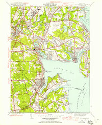
East Greenwich, Rhode Island: USGS topographic map, 1:24,000 (1942–1996)
1942–1996 · 6 editions

Chesapeake Bay watershed, percent area hydrological soil group "A" 1992
1992 · Library of Congress

Well watersheds, North and South Rivers basin, Norfolk and Plymouth Counties, Massachusetts
1981 · Library of Congress

Chesapeake Bay watershed, percent area pastureland, 1992
1992 · Library of Congress

Status of water resource projects, Connecticut - October 1987
1987 · Library of Congress

Surface geology map, Caesar Creek Watershed, Miami Valley Resource Conservation and Development Area - Clinton, Greene, and Warren counties, Ohio
1995 · Library of Congress

Potential groundwater hazards, North and South Rivers basin, Norfolk and Plymouth Counties, Massachusetts
1981 · Library of Congress