

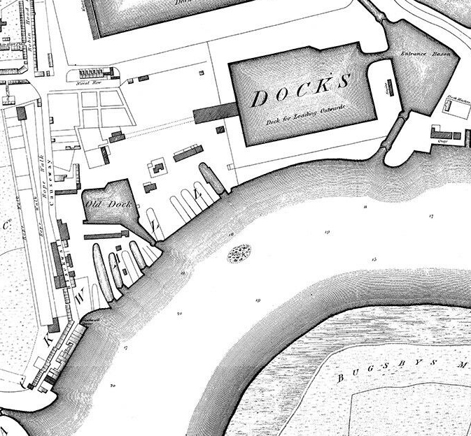
Greenland Dock 1763
Manuscript plan of the Greenland Dock, 1763
- Date
- July 12, 2008
- Mapmaker / publisher
- Original uploader was CMallwitz at en.wikipedia
- Place
- the Docks of London
- Archive
- Wikimedia Commons
- Type
- map
- Original size
- 969 × 920 pixels
Public domain
Reason: a US government work.
This status rests on the map's publication history, as researched by Wikimedia Commons. Check it before commercial use.
Read from: Commons licence category: PD US; no CC BY, CC BY-SA, GFDL or deletion tag on the file page; permission field: PD-US; PD-ART.; Commons tags it as a US government work, but its record names no government maker.
Credit line
"Greenland Dock 1763" (July 12, 2008). Original uploader was CMallwitz at en.wikipedia, via Wikimedia Commons. Public domain. https://commons.wikimedia.org/wiki/File:Greenland_Dock_1763.jpgNeed maps for a whole project? Add Find Any Map to Claude and ask for this one by its id: 293155.
More like this

The Limehouse end of the Limehouse Cut c.1800
1799 · Wikimedia Commons

Port Of London 1837
1837 · Wikimedia Commons

(D) WYATT'S PLAN
1877 · Wikimedia Commons
Horwood Blackwall
1813 · Wikimedia Commons

(J) REVELEY'S PLAN
1877 · Wikimedia Commons

Limehouse basins 1819
1819 · Wikimedia Commons

John Fairburn 7.5. 1800
May 7, 1800 · Wikimedia Commons

(A) EDWARD OGLES' PLAN
1877 · Wikimedia Commons