
Greatbeninitscus00roth 0151
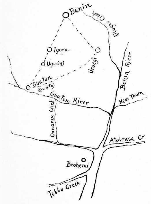
Sketch Plan by Mr. C. Punch, to show the position of the important Igora and Uruegi markets
- Date
- 1903
- Mapmaker / publisher
- C. Punch
- Place
- Benin
- Archive
- Wikimedia Commons
- Type
- map
- Original size
- 523 × 705 pixels
Public domainsafest
Reason: its maker died more than 70 years ago.
Read from: Commons licence category: PD-old-70-expired; no CC BY, CC BY-SA, GFDL or deletion tag on the file page.
Credit line
"Greatbeninitscus00roth 0151" (1903). C. Punch, via Wikimedia Commons. Public domain. https://commons.wikimedia.org/wiki/File:Greatbeninitscus00roth_0151.pngNeed maps for a whole project? Add Find Any Map to Claude and ask for this one by its id: 236437.
More like this

ROQUES(1892) p055 Fig.19
1895 · Wikimedia Commons

ROQUES(1892) p035 Fig.11
1895 · Wikimedia Commons

ROQUES(1892) p040 Fig.12
1895 · Wikimedia Commons

ROQUES(1892) p050 Fig.17
1895 · Wikimedia Commons

AFR V3 D376 Plan of Sokoto and Map of Haussa, Drawn by Sultan Bello
June 12, 1892 · Wikimedia Commons

ROQUES(1892) p009 Fig.1
1895 · Wikimedia Commons

Negro Culture in West Africa plate 26
1914 · Wikimedia Commons

AFR V3 D298 Route from Accra to Cumassi
June 12, 1892 · Wikimedia Commons