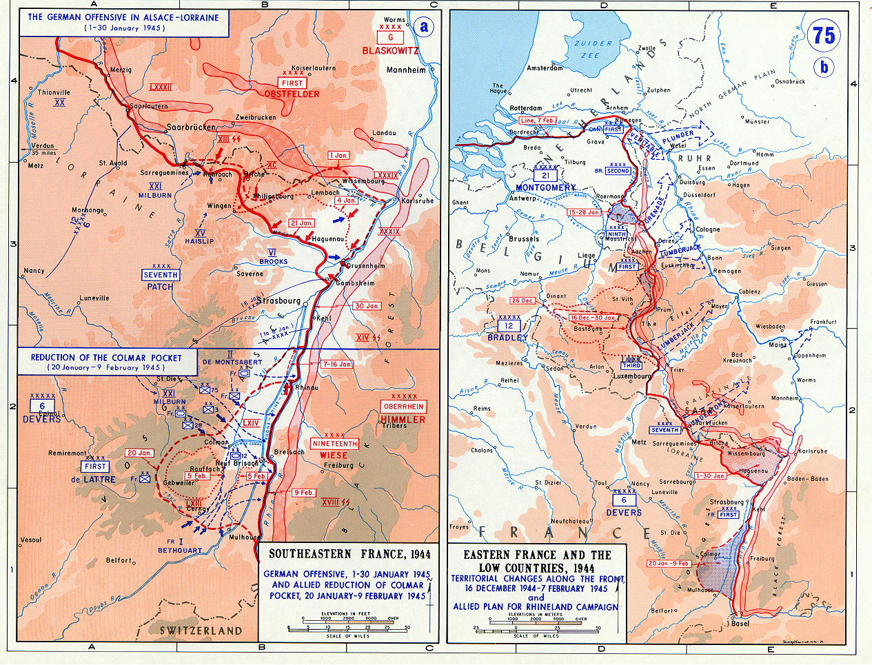

German counter in Alsace Lorraine
Operations map of German counter in Alsace Lorraine in January 1945. It is erronously titled "Southeastern France", when it actually shows the northeastern part of France.
- Date
- 1945
- Mapmaker / publisher
- US Army Military History Institute
- Place
- the history of Alsace
- Archive
- Wikimedia Commons
- Type
- map
- Original size
- 1,265 × 965 pixels
Public domainsafest
Reason: a US government work (US Army).
Read from: Commons licence category: PD US Army; no CC BY, CC BY-SA, GFDL or deletion tag on the file page.
Credit line
"German counter in Alsace Lorraine" (1945). US Army Military History Institute, via Wikimedia Commons. Public domain. https://commons.wikimedia.org/wiki/File:German_counter_in_Alsace_Lorraine.jpgNeed maps for a whole project? Add Find Any Map to Claude and ask for this one by its id: 23524.
More like this

This file shows the last major German offensive on the Western Front
Wikimedia Commons

Map of the Military operations in the Saar-Mosel triangle, Germany, 13 January to 1 March 1945
January 13, 1945 · Wikimedia Commons

Operation Undertone map
1973 · Wikimedia Commons

Allied counter-offensive Ardennes
June 5, 1972 · Wikimedia Commons

Operation Undertone Map 1945
1945 · Wikimedia Commons

Sixth AG offensive
1945 · Wikimedia Commons

Colmar Pocket Map
2007 · Wikimedia Commons

West front jan 3 1945
June 5, 1972 · Wikimedia Commons