

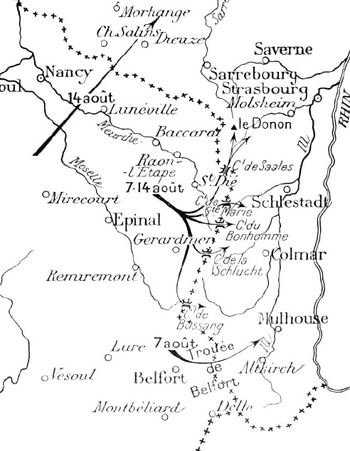
German and French mobilisation, 31 July – 3 August 1914
Map showing German and French mobilisation, 31 July – 3 August 1914
- Date
- 1914
- Mapmaker / publisher
- Michelin
- Archive
- Wikimedia Commons
- Type
- map
- Original size
- 452 × 645 pixels
Public domain
Reason: a US government work.
This status rests on the map's publication history, as researched by Wikimedia Commons. Check it before commercial use.
Read from: Commons licence category: PD US; no CC BY, CC BY-SA, GFDL or deletion tag on the file page.
Credit line
"German and French mobilisation, 31 July – 3 August 1914" (1914). Michelin, via Wikimedia Commons. Public domain. https://commons.wikimedia.org/wiki/File:German_and_French_mobilisation,_31_July_%E2%80%93_3_August_1914.jpgNeed maps for a whole project? Add Find Any Map to Claude and ask for this one by its id: 22754.
More like this
Initial moves, 7-20 August 1914
1914 · Wikimedia Commons

French German border, 1914
1914 · Wikimedia Commons

French withdrawl in Lorraine 20 23 august 1914
1919 · Wikimedia Commons

Verdun-St. Mihiel area, 9 September 1914
February 19, 2014 · Wikimedia Commons

Marne 1914, positions 5 September (dashed), 13 September (solid)
1914 · Wikimedia Commons

The Battle of the Frontiers - Mulhouse and Lorraine
Wikimedia Commons

Fortified regions in Northern France and Belgium, 1914
1914 · Wikimedia Commons

Positions of the armies before the Battle of the Marne, September 1914
1914 · Wikimedia Commons