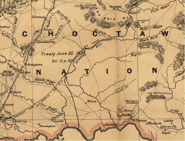

George Mayo Map
Indian territory: compiled from the official records of the records of the General Land Office and other sources under supervision of Geo. U. Mayo.
- Date
- 1887
- Mapmaker / publisher
- George U. Mayo, General Land Office (U.S. Government agency)
- Place
- Pushmataha County, Oklahoma
- Archive
- Library of Congress (via Wikimedia Commons)
- Type
- map
- Original size
- 623 × 474 pixels
Public domainsafest
Reason: a US government work.
Read from: Commons licence category: PD US Government; no CC BY, CC BY-SA, GFDL or deletion tag on the file page.
Credit line
"George Mayo Map" (1887). George U. Mayo, General Land Office (U.S. Government agency). Library of Congress, Geography and Map Division, via Wikimedia Commons. Public domain. https://commons.wikimedia.org/wiki/File:George_Mayo_Map.pngNeed maps for a whole project? Add Find Any Map to Claude and ask for this one by its id: 13052.
More like this

Indian territory- compiled from the official records of the records of the General Land Office and other sources under supervision of Geo. U. Mayo.
1887 · Library of Congress

Map of the Indian Territory showing Oklahoma country
1889 · Library of Congress

Indian territory- compiled under the direction of the Hon. John H. Oberly, Commissioner of Indian Affairs, by C.A. Maxwell.
1889 · Library of Congress

Map of Choctaw Nation, Indian territory - compiled from official records of the United States Geological Survey
1900 · Library of Congress

Indian Territory - compiled under the supervision of Charles H. Fitch, topographer in charge of the Indian Territory surveys
1898 · Library of Congress

Indian Territory - compiled under the direction of Charles H. Fitch, topographer in charge of the Indian Territory surveys
1898 · Library of Congress

Map of Chickasaw Nation, Indian territory
1900 · Library of Congress

Map of Choctaw Nation, Indian territory, coal and asphalt segregation
1903 · Library of Congress