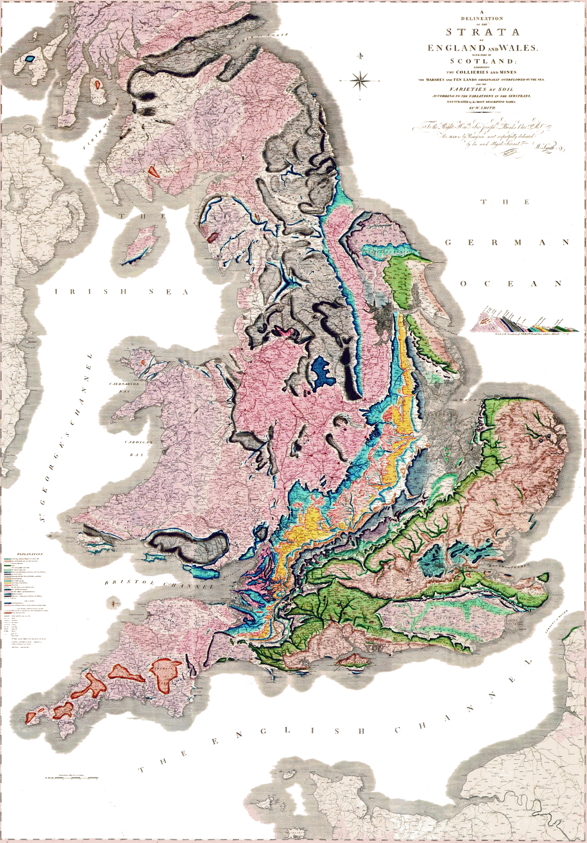

Geological map Britain William Smith 1815
A delineation of the strata of England and Wales with part of Scotland. (The first geological map of Britain, published by William Smith in 1815)
- Date
- 1815
- Mapmaker / publisher
- William Smith (1769-1839)
- Place
- England and Wales
- Archive
- Wikimedia Commons
- Type
- map
- Original size
- 1,200 × 1,769 pixels
Public domainsafest
Reason: its maker died more than 100 years ago.
Read from: Commons licence category: PD-old-100-expired; no CC BY, CC BY-SA, GFDL or deletion tag on the file page.
Credit line
"Geological map Britain William Smith 1815" (1815). William Smith (1769-1839), via Wikimedia Commons. Public domain. https://commons.wikimedia.org/wiki/File:Geological_map_Britain_William_Smith_1815.jpgNeed maps for a whole project? Add Find Any Map to Claude and ask for this one by its id: 244491.
More like this

Smith map
1815 · Wikimedia Commons

Geological map - William Smith, 1815 - BL
1815 · Wikimedia Commons

A Delineation of the Strata of England and Wales with part of Scotland exhibiting the Collieries and Mines, the Marshes and Fen Lands originally overflowed by the Sea and the varieties of soil according to the variations of the Substrata, illustrated by the most descriptive names
1815 · Wikimedia Commons

A new Geological map of England and Wales by William Smith
1820 · Wikimedia Commons

Map smith
1815 · Wikimedia Commons

Geological map of England and Wales. Reduced by permission from the map in 6 sheets published by the geological Society. 50 miles
1826 · Wikimedia Commons

William Smith geological map of Cumberland
1824 · Wikimedia Commons

Geological map of Great Britain
1904 · Wikimedia Commons