
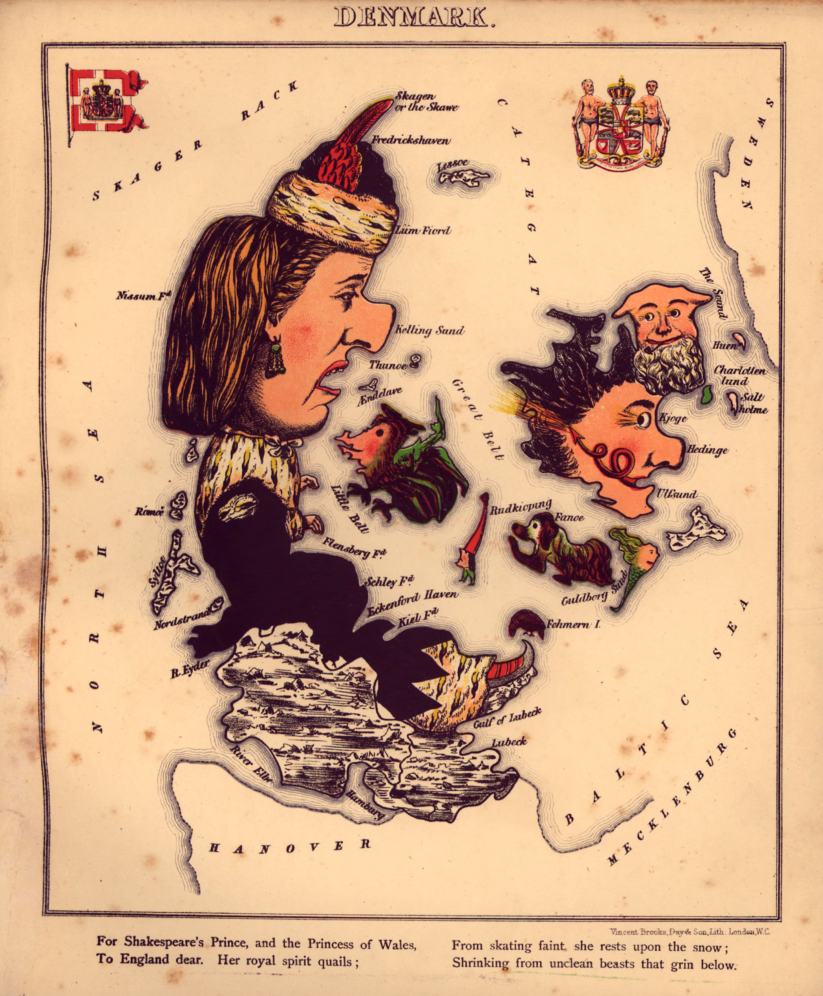
Geographical fun - being humourous outlines of various countries, with an introduction and descriptive lines
- Date
- 1868
- Mapmaker / publisher
- Harvey, William
- Archive
- Library of Congress (via Wikimedia Commons)
- Type
- map
- Sheets
- 15
- Original size
- 2,536 × 3,192 pixels
Public domainsafest
Reason: its maker died more than 100 years ago.
Read from: Commons licence category: PD-old-100-expired; no CC BY, CC BY-SA, GFDL or deletion tag on the file page.
Credit line
"Geographical fun - being humourous outlines of various countries, with an introduction and descriptive lines" (1868). Harvey, William. Library of Congress, Geography and Map Division, via Wikimedia Commons. Public domain. https://commons.wikimedia.org/wiki/File:Geographical_fun_-_being_humourous_outlines_of_various_countries,_with_an_introduction_and_descriptive_lines_LOC_84675540-1.jpgNeed maps for a whole project? Add Find Any Map to Claude and ask for this one by its id: 13038.
All 15 sheets
Each sheet links to its file at the archive; the image link is the full-size scan.



More like this

Geography 081 - Pictorial Atlas England
1796 · Wikimedia Commons

The geographical distribution of mammals. By Andrew Murray.
Wikimedia Commons

Geography 083 - Pictorial Atlas Germany
1796 · Wikimedia Commons

Geography 087 - Pictorial Atlas Scotland
1796 · Wikimedia Commons

Geography 084 - Pictorial Atlas Holland Belgium
1796 · Wikimedia Commons

Geography 086 - Pictorial Atlas Russia
1796 · Wikimedia Commons

Geography 082 - Pictorial Atlas France
1796 · Wikimedia Commons

Geography 088 - Pictorial Atlas Spain Portugal
1796 · Wikimedia Commons