

G3701 S5 1861 V5
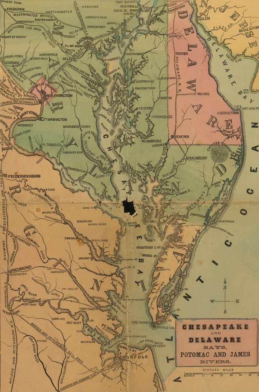
G3701_S5_1861_V5: H.H. Lloyd & Co’s Campaign Military Charts Showing the Principal Strategic Places of Interest during the Civil War. Maps of Annapolis, Key West, the Mississippi River, Chesapeake Bay and vicinity, Charleston, New Orleans, Savannah, Mobile Bay, the United States, Cairo, Pensacola Bay, Galveston Bay, Hampton Roads, Washington, D.C. and Harper’s Ferry. The maps indicate forts, towns, railroads and rivers. Created by Egbert L. Viele, published by H.H. Lloyd & Company, New York, 1861. Courtesy of the.
- Date
- 1861
- Mapmaker / publisher
- National Museum of the U.S. Navy
- Place
- the United States
- Archive
- Wikimedia Commons
- Type
- map
- Original size
- 8,608 × 11,381 pixels
Public domainsafest
Reason: a US government work (US Navy).
Read from: Commons licence category: PD US Navy; no CC BY, CC BY-SA, GFDL or deletion tag on the file page.
Credit line
"G3701 S5 1861 V5" (1861). National Museum of the U.S. Navy, via Wikimedia Commons. Public domain. https://commons.wikimedia.org/wiki/File:G3701_S5_1861_V5_(17815597505).jpgNeed maps for a whole project? Add Find Any Map to Claude and ask for this one by its id: 92.
More like this

H. H. Lloyd & Co's. campaign military charts showing the principal strategic places of interest
1861 · Library of Congress

Colton's plans of U. S. harbors showing the position & vicinities of the most important fortifications on the sea-board and in the interior
1862 · Library of Congress
Chesapeake and Delaware Bays H. H. Lloyd & Co.'s Military Charts Showing the Principal Strategic Places of Interest
1861 · Wikimedia Commons

Military map of the United States & territories showing the location of the military posts, arsenals, Navy Yards, & ports of entry. Compiled from pub-doc-1861.
1861 · Library of Congress

G3884 H2 2F6 186 D8
1860 · Wikimedia Commons

Wyld's military map of the United States, the northern states, and the southern confederate states- with the forts, harbours, arsenals, and military positions.
1861 · Library of Congress

New Orleans--Mouth of Mississippi H. H. Lloyd & Co.'s Military Charts Showing the Principal Strategic Places of Interest
1861 · Wikimedia Commons

Charts of Savannah River, Pensacola Bay, and Key West. Showing the positions of the several fortifications. From the United States Coast Survey
1861 · Library of Congress