

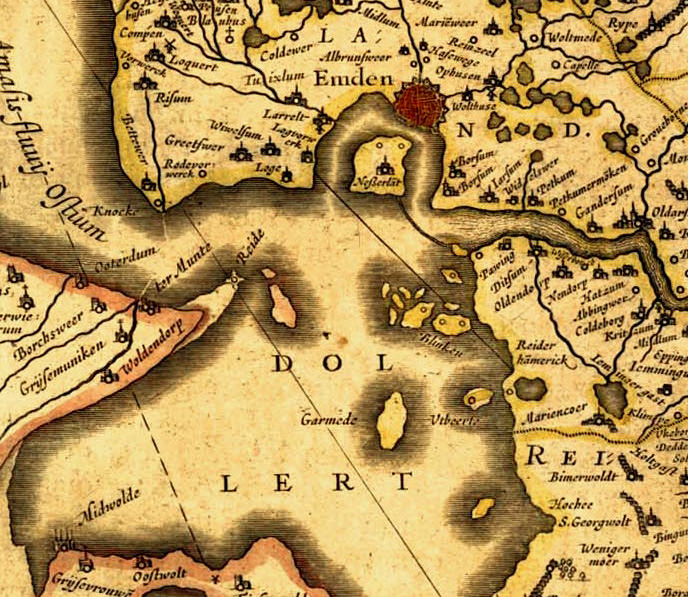
Frisiae, about 1600, by Ubbo Emmius
- Date
- c. 1600
- Place
- Lower Saxony
- Archive
- Wikimedia Commons
- Type
- map
- Original size
- 2,878 × 2,225 pixels
Public domain
Reason: its maker died long enough ago that the copyright has expired.
This status rests on the map's publication history, as researched by Wikimedia Commons. Check it before commercial use.
Read from: Commons licence category: PD Old; no CC BY, CC BY-SA, GFDL or deletion tag on the file page; permission field: public domain because of age.
Credit line
"Frisiae, about 1600, by Ubbo Emmius" (c. 1600). Wikimedia Commons. Public domain. https://commons.wikimedia.org/wiki/File:Frisiae,_about_1600,_by_Ubbo_Emmius.jpgNeed maps for a whole project? Add Find Any Map to Claude and ask for this one by its id: 252864.
More like this
Old map of East Frisia.
1600 · Wikimedia Commons

Emden-1640-Merian
1640 · Wikimedia Commons

De merian Westphaliae 113
Wikimedia Commons

Unterweser Jadebusen 1643-48
1640s · Wikimedia Commons

Emden 1575 (Braun Hogenberg, Band II, 1. Auflage)
1575 · Wikimedia Commons

Emden & Oldenborch comit. / per Gerardum Mercatorem
1607–1608 · Emden and Oldenburg, plate 1 of 2

Tabula Frisiae, Groningae et territorii Emdensis nec non circumjacentium regionum puta Transisalaniae, Benthemiae, Westphaliae et Oldenburgi
1682–1702 · Wikimedia Commons

1658 Wassende v Nierop
1658–1660 · Wikimedia Commons