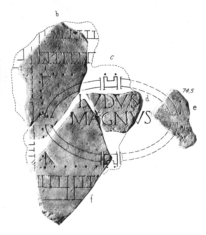

Forma Urbis Romae - ludus magnus
Fragmente der Forma Urbis Romae mit dem Verzeichnis des ludus magnus (nach: Gianfilippo Carettoni Taf. 17)
- Archive
- Wikimedia Commons
- Type
- map
- Original size
- 700 × 800 pixels
Public domain
Reason: public domain: scan (PD-old-70).
This status rests on the map's publication history, as researched by Wikimedia Commons. Check it before commercial use.
Read from: Commons licence category: PD-scan (PD-old-70); no CC BY, CC BY-SA, GFDL or deletion tag on the file page.
Credit line
"Forma Urbis Romae - ludus magnus". Wikimedia Commons. Public domain. https://commons.wikimedia.org/wiki/File:Forma_Urbis_Romae_-_ludus_magnus.jpgNeed maps for a whole project? Add Find Any Map to Claude and ask for this one by its id: 19865.
More like this

Ville de Paris. Plan cadastral du Quartier Bonne-Nouvelle. Cinquième arrondissement.
1807–1821 · Wikimedia Commons

Insurance Plan of London Vol. XII: Key Plan 3
1891 · Wikimedia Commons

Insurance Plan of City of London Vol. IV: Key Plan 3
1887 · Wikimedia Commons

Insurance Plan of City of London Vol. IV: Key Plan 2
1887 · Wikimedia Commons

Insurance Plan of London Vol. VI: Key Plan 1
1887 · Wikimedia Commons

Insurance Plan of London Vol. V: Key Plan 3
1887 · Wikimedia Commons

Insurance Plan of London Vol. V: Key Plan 2
1887 · Wikimedia Commons

Insurance Plan of London Vol. XII: Key Plan 4
1891 · Wikimedia Commons