

February 28 map 1936
The battle map as of AM6:00 February 28 1936, when the troops of the IJA 3rd & 57th Infantry Regiments surrounded the rebel force of the "February 26 Incident".
- Date
- March 1, 1936
- Mapmaker / publisher
- 戒厳司令部参謀部第二課 Martial Law HQ of 1936
- Place
- the February 26 Incident
- Archive
- Wikimedia Commons
- Type
- map
- Original size
- 1,200 × 888 pixels
Public domain
Reason: published outside the US before 1996 and already public domain in its home country then.
This status rests on the map's publication history, as researched by Wikimedia Commons. Check it before commercial use.
Read from: Commons licence category: PD-1996; no CC BY, CC BY-SA, GFDL or deletion tag on the file page; permission field: PD-Japan-organization..
Credit line
"February 28 map 1936" (March 1, 1936). 戒厳司令部参謀部第二課 Martial Law HQ of 1936, via Wikimedia Commons. Public domain. https://commons.wikimedia.org/wiki/File:February_28_map_1936.jpgNeed maps for a whole project? Add Find Any Map to Claude and ask for this one by its id: 24479.
More like this

February 29 map 1936
March 1, 1936 · Wikimedia Commons
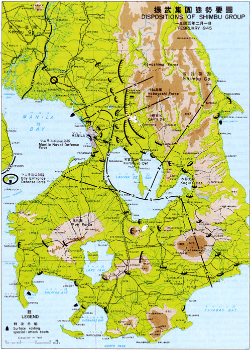
Dispositions of the Shimbu Group
August 6, 2007 · Wikimedia Commons

(February 26, 1945), HQ Twelfth Army Group situation map.
February 26, 1945 · Library of Congress

(February 28, 1945), HQ Twelfth Army Group situation map.
February 28, 1945 · Library of Congress

Battle of the Amur River 1945
September 30, 1954 · Wikimedia Commons

(February 27, 1945), HQ Twelfth Army Group situation map.
February 27, 1945 · Library of Congress

Sixth Army advances on Shimbu Group east of Manila
May 1, 1945 · Wikimedia Commons

Layac Junction Jan 1942
1953 · Wikimedia Commons