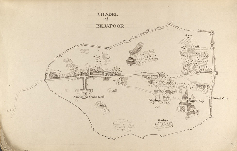

F.3' Citadel of Bejapoor. Plan.
تخطيط حصن بيجافور. f.3' Citadel of Bejapoor. Plan.'
- Date
- 1821
- Mapmaker / publisher
- Boyd, George (1800-1850)
- Place
- Bijapur
- Archive
- Wikimedia Commons
- Type
- map
- Original size
- 976 × 621 pixels
Public domain
Reason: its maker died long enough ago that the copyright has expired.
This status rests on the map's publication history, as researched by Wikimedia Commons. Check it before commercial use.
Read from: Commons licence category: PD Old; no CC BY, CC BY-SA, GFDL or deletion tag on the file page.
Credit line
"F.3' Citadel of Bejapoor. Plan." (1821). Boyd, George (1800-1850), via Wikimedia Commons. Public domain. https://commons.wikimedia.org/wiki/File:F.3%27_Citadel_of_Bejapoor._Plan..jpgNeed maps for a whole project? Add Find Any Map to Claude and ask for this one by its id: 256825.
More like this

Dalrymple 1791 Colar orientalrepertor01dalr 0662
1791 · Wikimedia Commons

Dalrymple 1792 Plan of Ossour orientalrepertor01dalr 0664
January 25, 1792 · Wikimedia Commons

Bijapur Murray
1911 · Wikimedia Commons

Dalrymple 1793 Plan of the Fort and Outer Wall of Ourangal or Warangole 646
December 28, 1793 · Wikimedia Commons

Dalrymple 1792 Khalinger Fort orientalrepertor01dalr 0650
July 1, 1792 · Wikimedia Commons

Map of Kolhapur city, 1830
1830 · Wikimedia Commons

Dalrymple 1795 Bidanure and Anantapore 660
June 24, 1795 · Wikimedia Commons

Plan du fort de l'aldée de Chétoupetle. pris d'assaut par l'armée française le 14 octobre 1757. (par le capitaine du génie Leveux)
1757 · Wikimedia Commons