
Expedition Gustav Conrau Kamerun 1896-97
New recordings by Gustav Conrau in the north and northwestern parts of the Cameroon Mountains in the years 1896 and 1897
- Date
- 1896–1897
- Mapmaker / publisher
- Gustav Conrau
- Place
- Cameroon
- Archive
- Wikimedia Commons
- Type
- map
- Sheets
- 2
- Original size
- 910 × 500 pixels
Public domain
Reason: its maker died long enough ago that the copyright has expired.
This status rests on the map's publication history, as researched by Wikimedia Commons. Check it before commercial use.
Read from: Commons licence category: PD Old; no CC BY, CC BY-SA, GFDL or deletion tag on the file page.
Credit line
"Expedition Gustav Conrau Kamerun 1896-97" (1896–1897). Gustav Conrau, via Wikimedia Commons. Public domain. https://commons.wikimedia.org/wiki/File:Expedition_Gustav_Conrau_Kamerun_1896-97_(cropped).pngNeed maps for a whole project? Add Find Any Map to Claude and ask for this one by its id: 236473.
All 2 sheets
Each sheet links to its file at the archive; the image link is the full-size scan.


More like this

Carte de la région entre Congo, Bénoué et Chari (aux 31 Xbre, 1895).
1895 · Wikimedia Commons

Expeditionsskizze Kund1888
1888 · Wikimedia Commons

Baumwollkarte Kamerun 1909
1909–1910 · Wikimedia Commons

Carte de la frontière entre le Cameroun et le Congo français entre les longitudes 13° 20 et 15° 40 Est Greenwich, 11° et 13° 20 Est Paris
1880–1900 · Wikimedia Commons

Karte von Camerun
1888 · Wikimedia Commons
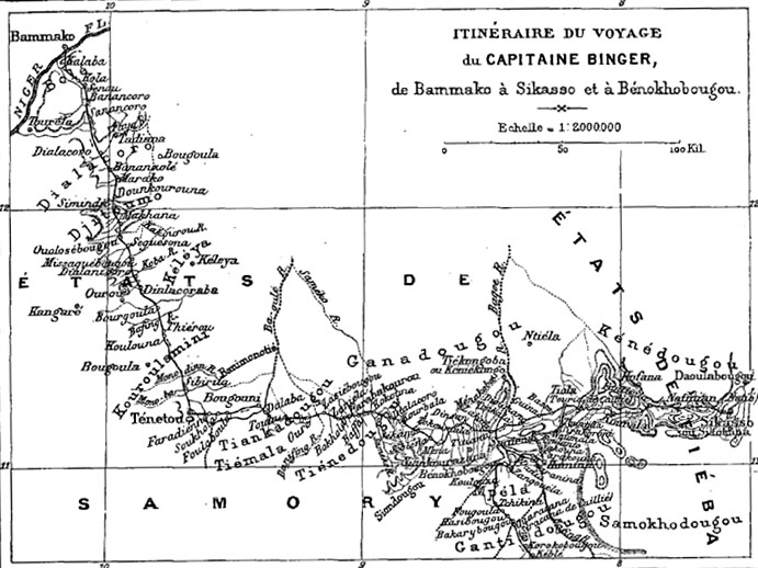
"Itinéraire du voyage du capitaine Binger, de Bammako à Sikasso et à Bénokhobougou", in Du Niger au golfe de Guinée (Louis-Gustave Binger), reproduit dans Le Tour du Monde, 1891, premier semestre, tom
1891 · Wikimedia Commons

Hugo Zoeller Mount Cameroon 1885
1885 · Wikimedia Commons

Itinéraire de l'Ogôoué au Campo par A. Fourneau
1889 · Wikimedia Commons