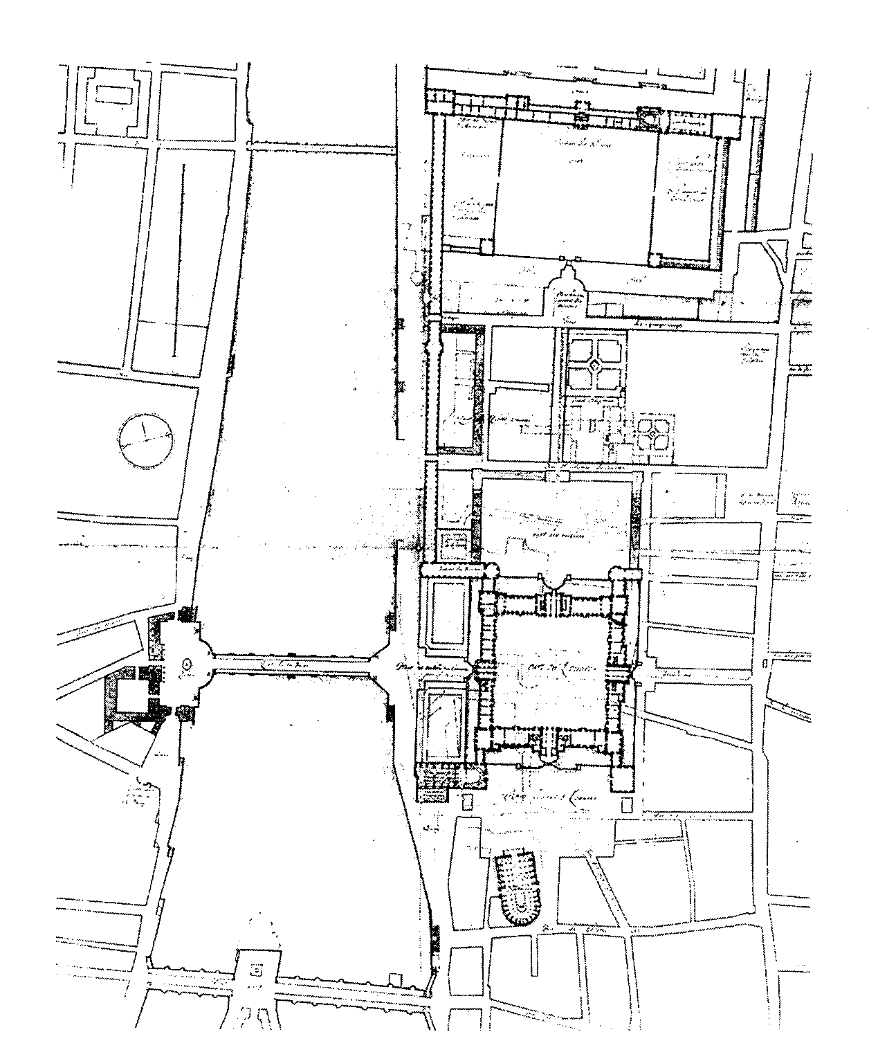

Expansion plan of Palais du Louvre
(1660) by Louis Le Vau
- Date
- 1660
- Mapmaker / publisher
- Louis Le Vau(1620 - 1670)
- Archive
- Wikimedia Commons
- Type
- map
- Original size
- 1,269 × 1,530 pixels
CC0safest
Reason: CC0: dedicated to the public domain.
Read from: Commons licence category: CC-Zero; no CC BY, CC BY-SA, GFDL or deletion tag on the file page.
Credit line
"Expansion plan of Palais du Louvre" (1660). Louis Le Vau(1620 - 1670), via Wikimedia Commons. CC0. https://commons.wikimedia.org/wiki/File:Expansion_plan_of_Palais_du_Louvre.pngNeed maps for a whole project? Add Find Any Map to Claude and ask for this one by its id: 299203.
More like this

Paris, Palais du Louvre: plans de portions du Louvre du côté de la rue du Coq et de la Colonnade: dessin
1750 · Wikimedia Commons

Plan of the Louvre with the modifications by Lescot - Berty 1868 after p168 – Gallica 2013 (adjusted)
1868 · Wikimedia Commons

Albert Lenoir & Adolphe Berty, Histoire topographique et archéologique de l'ancien Paris - Gallica
Wikimedia Commons

Drawing of an enlarged project of 1578 to 1579 for the Tuileries, by Jacques Androuet du Cerceau
c. 1579 · Wikimedia Commons

Louvre et Tuileries - Plan général de la disposition actuelle des bâtimens - Architecture françoise Tome4 Livre6 Pl4
1756 · Wikimedia Commons

Plan historique du Louvre, 1850-1900 - Gallica
1850 · Wikimedia Commons

Bastiments v1 (Gregg 1972 p27) - Louvre second and first storey plans
1576 · Wikimedia Commons

Réunion des Tuileries au Louvre 1852–1857 Getty Museum vol1 02 Plan of the Louvre by Charles Vasserot 1830 – Getty Museum (crop)
1853 · Wikimedia Commons