

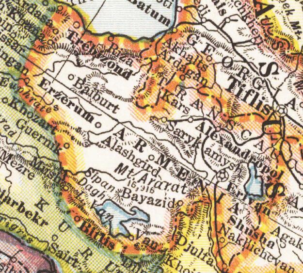
Europe map 1919 cropped
Map of:en:Europe political divisions in 1919 (after the treaties of Brest-Litovsk and Versailles and before the treaties of Trianon, Riga, Kars and the establishment of:en:Soviet Union and the republics of Ireland and Turkey) published by London Geographical Institute. This uploaded map is a photoshopped version of the original image located at hipkiss.org. According to the site, there are no copyrights to this map. This crop includes territories as of 1919: Ukraine, Azerbaijan Democratic Republic, Armenia, Georgia, Abkhazia, Kuban People's Republic, Mountainous Republic of the Northern Caucasus
- Date
- 1919
- Mapmaker / publisher
- Europe_map_1919.jpg: Original uploader was MaGioZal at en.wikipedia *derivative work: Geagea ( talk )
- Place
- Armenia
- Archive
- Wikimedia Commons
- Type
- map
- Original size
- 738 × 437 pixels
Public domain
Reason: a US government work.
This status rests on the map's publication history, as researched by Wikimedia Commons. Check it before commercial use.
Read from: Commons licence category: PD US; no CC BY, CC BY-SA, GFDL or deletion tag on the file page.
Credit line
"Europe map 1919 cropped" (1919). Europe_map_1919.jpg: Original uploader was MaGioZal at en.wikipedia *derivative work: Geagea ( talk ), via Wikimedia Commons. Public domain. https://commons.wikimedia.org/wiki/File:Europe_map_1919_cropped.JPGNeed maps for a whole project? Add Find Any Map to Claude and ask for this one by its id: 242673.
More like this

London-geographical-institute the-peoples-atlas 1920 the-partition-of-russia-in-europe 3012 3992 600 cropped
1920 · Wikimedia Commons

Europe 1911 Caucasus and the Black Sea
1911 · Wikimedia Commons

Asia Minor and the Caucasus 1919
1922 · Wikimedia Commons

London-geographical-institute the-peoples-atlas 1920 the-partition-of-russia-in-europe 3012 3992 600 cropped - The Black Sea
1920 · Wikimedia Commons

General Anton Denikin's Volunteer Army and regional Armed forces after Armistice of Mudros. Place of Dunsterforce forces after Armstice. Place of British forces after Armstice.:en:Russian Civil War -
1919 · Wikimedia Commons
Wilsonian Armenia National Geographic 1921
1921 · Wikimedia Commons

Avrupa 1914
1914 · Wikimedia Commons

Treaty of Sèvres &Soviet Republics of Transcaucasia
August 10, 1921 · Wikimedia Commons