

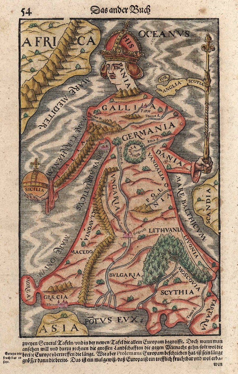
Europa regina by Sebastian Münster
Sebastian Münster: Cosmographey das ist Beschreibung Aller Länder herrschafften und für-nemesten Stetten des gantzen Erdbodens. Sebastianus Henripetri, Basel 1598, p. xli. See the edition from 1598: Europe is illustrated as a queen, an illustration that was published in Munster`s Cosmographia since 1588 and originally was created in 1534 by Johannes Bucius. The crown and the head are formed by Spain, England and Scotland are isles at the sceptre, the upper body build Gallia and Germania, the arms are Denmark and Italy with Sicilia as an orb, the lower body is built by the states Bulgaria, Greece, Hungary, Lithuania, Macedonia, Poland, Russia, Scythia and others. On the front- side you see the nice coloured view, on the back-side there is a general description in German.
- Date
- 1598
- Mapmaker / publisher
- Sebastian Munster
- Archive
- Wikimedia Commons
- Type
- map
- Original size
- 4,512 × 7,212 pixels
Public domainsafest
Reason: its maker died more than 70 years ago.
Read from: Commons licence category: PD-old-70-expired; no CC BY, CC BY-SA, GFDL or deletion tag on the file page.
Credit line
"Europa regina by Sebastian Münster" (1598). Sebastian Munster, via Wikimedia Commons. Public domain. https://commons.wikimedia.org/wiki/File:Europa_regina_by_Sebastian_M%C3%BCnster.jpgNeed maps for a whole project? Add Find Any Map to Claude and ask for this one by its id: 252051.
More like this

BASA-2115K-4-12-1(1)-Map of Europe
1588 · Wikimedia Commons

Europa Regina by Sebastian Münster
1628 · Wikimedia Commons

Europe shaped into a queen
1628 · Wikimedia Commons
Europe As A Queen Sebastian Munster 1570
1628 · Wikimedia Commons

Anthropomorphic map of Europe by Heinrich Bünting
1595 · Wikimedia Commons

Europe
Wikimedia Commons

QUAD Europae descriptio 1587
1587 · Wikimedia Commons

Europa Regina Retz
1530s · Wikimedia Commons