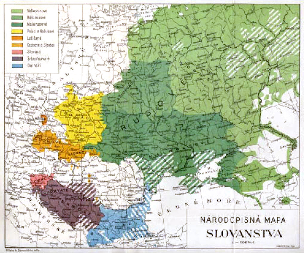

Ethnographic map of Slavs, Lubor Niederle
A picture from a book by Czech archaeologist:en:Lubor Niederle "Slavic Antiquities" (Slovanské starožitnosti), series published between 1902-24. The name can be translated as "Ethnographical map of Slavs". Textual description for the colors says:; all green - People of Rus; lightest green - Great Russians (Russians); green - White russians (Belarusians); dark green - Little Russians (Ukrainians); yellow - Poles and Kashubians; orange - Lusatian Serbs; light orange - Czechs and Slovaks; pink - Slovenians; brown - Serbo-Croatians; blue - Bulgarians
- Date
- 1902
- Mapmaker / publisher
- Uploaded to Wikipedia on 17:50, July 7, 2006 by w:User:Pavel Vozenilek
- Place
- ethnic groups in Belarus
- Archive
- Wikimedia Commons
- Type
- map
- Original size
- 1,017 × 847 pixels
Public domainsafest
Reason: its maker died more than 80 years ago.
Read from: Commons licence category: PD-old-80; no CC BY, CC BY-SA, GFDL or deletion tag on the file page.
Credit line
"Ethnographic map of Slavs, Lubor Niederle" (1902). Uploaded to Wikipedia on 17:50, July 7, 2006 by w:User:Pavel Vozenilek, via Wikimedia Commons. Public domain. https://commons.wikimedia.org/wiki/File:Ethnographic_map_of_Slavs,_Lubor_Niederle.JPGNeed maps for a whole project? Add Find Any Map to Claude and ask for this one by its id: 252211.
More like this

Етноґрафічна карта славянщини
1900–1930 · Wikimedia Commons

Languages in Central Europe 1910
1910 · Wikimedia Commons

East European population and languages - Russian map of 1907
1907 · Wikimedia Commons

Central Europe (ethnic)
19th century · Wikimedia Commons

C. 900 Peoples of Europe
c. 1911 · Wikimedia Commons

Europe ethnic map 1897 (hungarian)
1897 · Wikimedia Commons

Dialektologicheskaia Karta 1914 goda
1914 · Wikimedia Commons

Austria hungary 1911
1911 · Wikimedia Commons