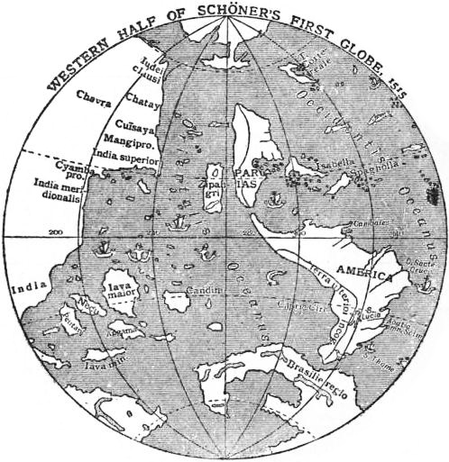

EB1911 Map - Fig. 29
Western Half of Schöner's First Globe, 1515
- Date
- 1911
- Place
- the globes by Johannes Schöner
- Archive
- Wikimedia Commons
- Type
- map
- Original size
- 498 × 513 pixels
Public domainsafest
Reason: its US copyright has expired (published before 1931).
Read from: Commons licence category: PD US expired; no CC BY, CC BY-SA, GFDL or deletion tag on the file page.
Credit line
"EB1911 Map - Fig. 29" (1911). Wikimedia Commons. Public domain. https://commons.wikimedia.org/wiki/File:EB1911_Map_-_Fig._29.jpgNeed maps for a whole project? Add Find Any Map to Claude and ask for this one by its id: 145425.
More like this

EB1911 Map - Fig. 30.—Lenox Globes
1911 · Wikimedia Commons

Johannes Schoner globe 1533 f m02
1533 · Wikimedia Commons

1523-24 Terrestrial globe of Johannes Schöner - Plate 1
1523 · Wikimedia Commons

RAINAUD(1893) Fig. 22. Le globe du moine François (1526-1530)
1893 · Wikimedia Commons

Globus Jagellonicus - Fig 3 from Estreicher 1901
1901 · Wikimedia Commons

Nordenskiöld 1889 Figure 46 BSG FOLSCSUP1940NOR 0093
1889 · Wikimedia Commons

Nordenskiöld 1889 Figure 47 BSG FOLSCSUP1940NOR 0094
1889 · Wikimedia Commons

1523-24 Terrestrial globe of Johannes Schöner - Plate 2
1523 · Wikimedia Commons