

Eastern Roman Empire (1040-1064)
Map of the Eastern Roman (Byzantine) Empire circa 1254 CE, showing changes from 1025-1472 CE
- Date
- 1888–1897
- Mapmaker / publisher
- W. & A. K. Johnston
- Place
- the Byzantine Empire in the 11th century
- Archive
- Wikimedia Commons
- Type
- atlas page
- Original size
- 1,905 × 1,438 pixels
Public domain
Reason: its maker died long enough ago that the copyright has expired.
This status rests on the map's publication history, as researched by Wikimedia Commons. Check it before commercial use.
Read from: Commons licence category: PD Old; no CC BY, CC BY-SA, GFDL or deletion tag on the file page.
Credit line
"Eastern Roman Empire (1040-1064)" (1888–1897). W. & A. K. Johnston, via Wikimedia Commons. Public domain. https://commons.wikimedia.org/wiki/File:Eastern_Roman_Empire_(1040-1064).jpgNeed maps for a whole project? Add Find Any Map to Claude and ask for this one by its id: 246108.
More like this

Historical atlas of modern Europe: from the decline of the Roman Empire: comprising also maps of parts of Asia, Africa, and the New World connected with Europaean history
Wikimedia Commons

ByzantineEmpire1045AD2lightpurple
Wikimedia Commons

South-eastern Europe 1040
1903 · Wikimedia Commons

Spruner-Menke Hand-Atlas für die Geschichte des Mittelalters und der neueren Zeit.
Wikimedia Commons

Byzantine Empire (PSF)
Wikimedia Commons
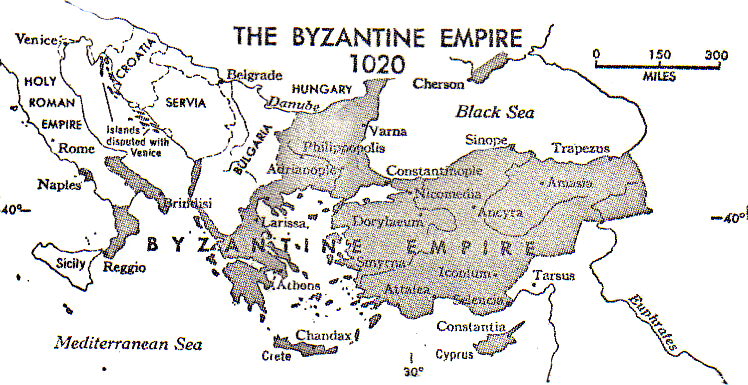
Byzantine Empire PSF
Wikimedia Commons

Byzantine empire just before the battle of Manzikert. I made it, or edited it from a map that was freely available from one of Wikipedia's users.
May 12, 2007 · Wikimedia Commons

Byzantine empire at 1081
August 21, 2007 · Wikimedia Commons