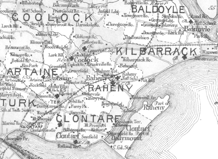

Dublin 1901 NE B
Dublin and north-eastern suburbs, with formal civic boundaries as at 1901
- Date
- 1901
- Mapmaker / publisher
- L J Richards
- Place
- Dublin
- Archive
- Wikimedia Commons
- Type
- map
- Original size
- 876 × 640 pixels
Public domain
Reason: its maker died long enough ago that the copyright has expired.
This status rests on the map's publication history, as researched by Wikimedia Commons. Check it before commercial use.
Read from: Commons licence category: PD Old; no CC BY, CC BY-SA, GFDL or deletion tag on the file page; permission field: Public domain (all USA pre-1923).
Credit line
"Dublin 1901 NE B" (1901). L J Richards, via Wikimedia Commons. Public domain. https://commons.wikimedia.org/wiki/File:Dublin_1901_NE_B.pngNeed maps for a whole project? Add Find Any Map to Claude and ask for this one by its id: 245507.
More like this

Dublin and district. Reduced from the 1/10 560 Scale of 1906-8. Partially revised in 1931
1935 · Wikimedia Commons

DINGNAM(1891) p019 MAP OF DUBLIN
1891 · Wikimedia Commons

Dublin MKL Bd. 5 1890
1890 · Wikimedia Commons

1797 map of Dublin city.
1797 · Wikimedia Commons

SULLIVAN(1888) p039 Map of the City of Dublin
1888 · Wikimedia Commons

Dublin 1610 1896
1896 · Wikimedia Commons

1836 Dublin, drawn by W.B. Clarke, archt; engraved by E. Turrell; published under the Superintendence of the Society for the Diffusion of Useful Knowledge, from the Digital Commonwealth - commonwealth ht2505534
1836 · Wikimedia Commons

A plan of the city of Dublin - as surveyed for the use of the division(a)l justices to which have been added plans of the canal harbour and its junction with the Grand Canal, the Royal Canal, and
1797 · Library of Congress