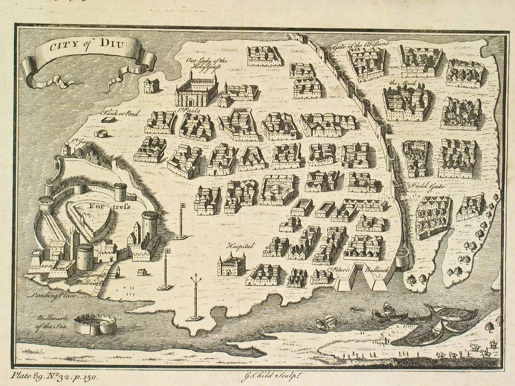

Diu map1729
"The East Indies" (South and Southeast Asia): *the whole map*: *northwest* (shown above); *northeast*; *southwest*; *southeast*; miniature maps mostly from 'The Universal Traveller' by Thomas Salmon, London, 1752 1729, many with modern hand coloring: *Fort St. George and Madras (1739) from 'Modern History'*: *northwest*; *northeast*; *southwest*; *southeast* *the Malabar Coast (1752)*: *northwest*; *northeast*; *southwest*; *southeast* *Plan of the city of Cochin* *the King of Cochin; and small Malabar boats*; *closer view* *Plan of the city of Diu* *Clothing of a Banian of India, and of the Siamese*; *a detail* A later map by Salmon from 'A New Geographical and Historical Grammar.' (W. Johnston, London), 1766: *"East Indies"*: *northwest*; *northeast*; *southwest*; *southeast*; *the South* *"Asia" (1752)*: *northwest*; *northeast*; *southwest*; *southeast*; *South Asia* *"Asia" (1766)*: *northwest*; *northeast*; *southwest*; *southeast*; *South and Southeast Asia* *"Persia" (1752)*: *northwest*; *northeast*; *southwest*; *southeast* *"Little Bochara" (1752)*: *northwest*; *northeast*; *southwest*; *southeast* *"Western Tartary" (1752)*: *northwest*; *northeast*; *southwest
- Date
- 1752
- Mapmaker / publisher
- Thomas Salmon
- Place
- Diu
- Archive
- Wikimedia Commons
- Type
- map
- Original size
- 1,024 × 768 pixels
Public domain
Reason: its maker died long enough ago that the copyright has expired.
This status rests on the map's publication history, as researched by Wikimedia Commons. Check it before commercial use.
Read from: Commons licence category: PD Old; no CC BY, CC BY-SA, GFDL or deletion tag on the file page.
Credit line
"Diu map1729" (1752). Thomas Salmon, via Wikimedia Commons. Public domain. https://commons.wikimedia.org/wiki/File:Diu_map1729.jpgNeed maps for a whole project? Add Find Any Map to Claude and ask for this one by its id: 256677.
More like this

The East Indies (South and Southeast Asia) the whole map miniature maps mostly from 'The Universal Traveller' by Thomas Salmon, London
1729–1766 · Wikimedia Commons

A later map by Salmon from 'A New Geographical and Historical Grammar.' (W. Johnston, London), 1766 eastindies northwest
1729–1766 · Wikimedia Commons

A later map by Salmon from 'A New Geographical and Historical Grammar.' (W. Johnston, London), 1766 asia (1752) south east
1729–1766 · Wikimedia Commons

A later map by Salmon from 'A New Geographical and Historical Grammar.' (W. Johnston, London), 1766 east indies sputh east
1729–1766 · Wikimedia Commons

A later map by Salmon from 'A New Geographical and Historical Grammar.' (W. Johnston, London), 1766 East Indies
1729–1766 · Wikimedia Commons

"The East Indies" (South and Southeast Asia): *the whole map*: *northwest* (shown above); *northeast*; *southwest*; *southeast*; miniature maps mostly from 'The Universal Traveller' by Thomas Salmon,
1752 · China

A later map by Salmon from 'A New Geographical and Historical Grammar.' (W. Johnston, London), 1766 asia (1766) north west
1729–1766 · Wikimedia Commons

Map of Diu
1746–1759 · Wikimedia Commons