

DISTRICT(1888) p111 - Temple (map)
1888 plan of the area around and the eastern part of the, including and churches. The area around Wych Street north of the Strand was demolished and redeveloped in the early 1900s to create the; it later became the site of and.
- Date
- 1888
- Archive
- Wikimedia Commons
- Type
- map
- Original size
- 692 × 734 pixels
Public domainsafest
Reason: its maker died more than 70 years ago.
Read from: Commons licence category: PD-old-70-expired; no CC BY, CC BY-SA, GFDL or deletion tag on the file page.
Credit line
"DISTRICT(1888) p111 - Temple (map)" (1888). Wikimedia Commons. Public domain. https://commons.wikimedia.org/wiki/File:DISTRICT(1888)_p111_-_Temple_(map).jpgNeed maps for a whole project? Add Find Any Map to Claude and ask for this one by its id: 292224.
More like this

DISTRICT(1888) p051 - Elephant and Castle (map)
1888 · Wikimedia Commons

DISTRICT(1888) p106 - Ludgate Hill (map)
1888 · Wikimedia Commons

DISTRICT(1888) p039 - Inner Circle sketch
1888 · Wikimedia Commons

DISTRICT(1888) p082 - St Paul's (map)
1888 · Wikimedia Commons
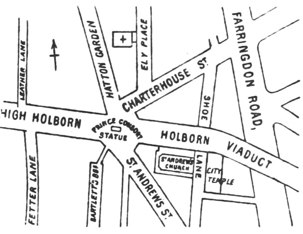
DISTRICT(1888) p091 - Holborn Circus (map)
1888 · Wikimedia Commons

DISTRICT(1888) p121 - St James's Park (map)
1888 · Wikimedia Commons

DISTRICT(1888) p125 - Sloane Square (map)
1888 · Wikimedia Commons

DISTRICT(1888) p115 - Charing Cross (map)
1888 · Wikimedia Commons