

Deutscher Kolonialatlas mit Jahrbuch
- Date
- 1910
- Place
- China
- Archive
- Wikimedia Commons
- Type
- map
- Original size
- 7,111 × 7,220 pixels
Public domain
Reason: public domain: anon-expired.
This status rests on the map's publication history, as researched by Wikimedia Commons. Check it before commercial use.
Read from: Commons licence category: PD-anon-expired; no CC BY, CC BY-SA, GFDL or deletion tag on the file page.
Credit line
"Deutscher Kolonialatlas mit Jahrbuch" (1910). Wikimedia Commons. Public domain. https://commons.wikimedia.org/wiki/File:Deutscher_Kolonialatlas_mit_Jahrbuch_1910_(133566334).jpgNeed maps for a whole project? Add Find Any Map to Claude and ask for this one by its id: 24537.
More like this

Deutsch-China (Flemming 1916)
1916 · Wikimedia Commons
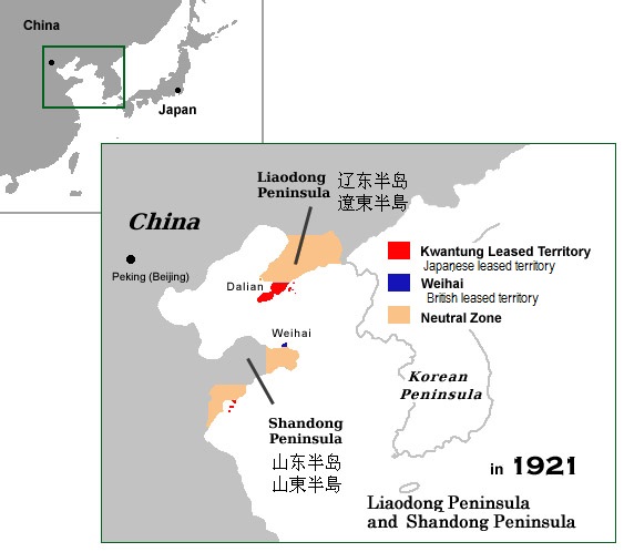
Kwantung territory China 1921
December 30, 2006 · Wikimedia Commons

F. W. Putzgers Historischer Schul-Atlas: zur alten, mittleren und neuen Geschichte
Wikimedia Commons

Kiauchau, 1914
1914 · Wikimedia Commons

Der deutsch-französische Krieg 1870-71. Suppl. 1, Karten und Pläne.
1870 · Wikimedia Commons

Hand-Atlas über alle Theile der Erde nach dem neuesten Zustande und über das Weltgebäude
Wikimedia Commons

Chinese South Sea
Wikimedia Commons

F.W. Putzgers Historischer Schul-Atlas: zur alten, mittleren und neuen Geschichte: in 66 Haupt- und 63 Nebenkarten
Wikimedia Commons