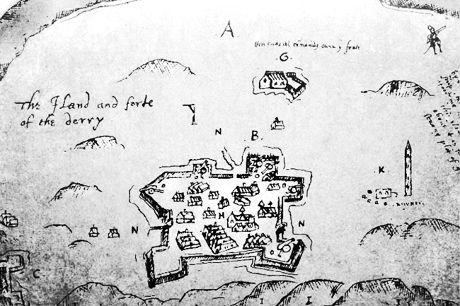

Derry, Ireland 1607
"The land and fort of Derry”, oldest known map of English colonial fort Derry, dated 27 December 1600. Derry was sacked and burned by the O'Doherty & McDavitt clans in 1608.
- Date
- 1607
- Mapmaker / publisher
- Kabuto 7
- Place
- cities in Northern Ireland
- Archive
- Wikimedia Commons
- Type
- map
- Original size
- 650 × 433 pixels
Public domainsafest
Reason: its maker died more than 100 years ago, and a faithful scan of a flat work adds no new copyright.
Read from: Commons licence category: PD-Art (PD-old-100); no CC BY, CC BY-SA, GFDL or deletion tag on the file page.
Credit line
"Derry, Ireland 1607" (1607). Kabuto 7, via Wikimedia Commons. Public domain. https://commons.wikimedia.org/wiki/File:Derry,_Ireland_1607.jpgNeed maps for a whole project? Add Find Any Map to Claude and ask for this one by its id: 245749.
More like this

CANE(1859) p054 MAP OF LONDONDERRY
1859 · Wikimedia Commons

16th Century Map of Cork - Extracted and replicated from Pacata Hibernia page 137
1585–1633 · Wikimedia Commons

Dungannon Castle and the stone chair at Tullyhogue, Co. Tyrone
1602 · Wikimedia Commons

WALKER(1893) p197 MAP OF DERRY - AS BESIGED IN 1688-89
1893 · Wikimedia Commons

Thomas Raven 1622 co. Londonderry plantation guilds
1622 · Wikimedia Commons

Probably the earliest depiction of Calicut, from 1572
1572 · Wikimedia Commons

The Seidge of Dunboy
2 sheets

Map of Limerick (around 1690)
c. 1690 · Wikimedia Commons