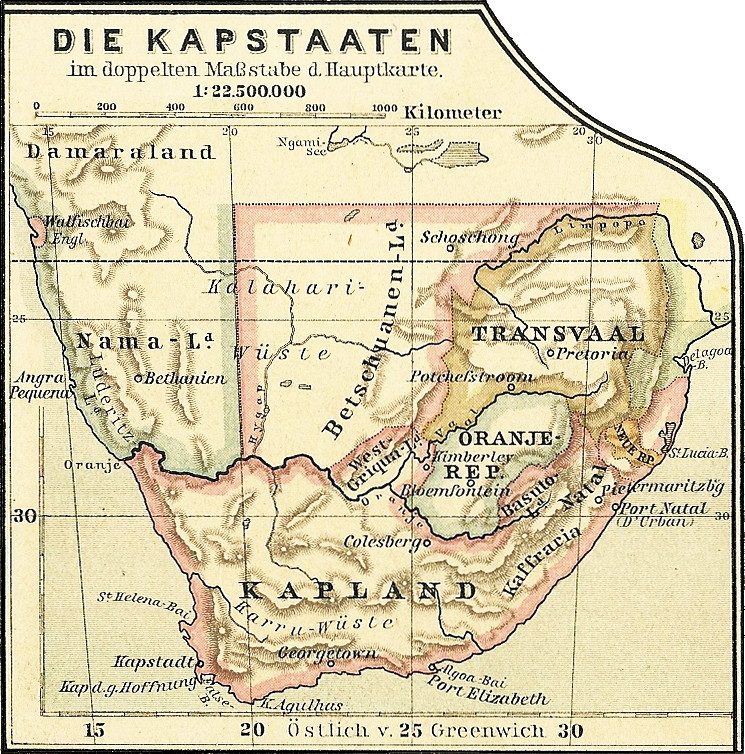

Debes 1888 Kapstaaten
Map of South Africa in 1888. Inset of map:File:Debes 1888 Afrika.jpg.
- Date
- April 16, 2019
- Mapmaker / publisher
- Wickey
- Place
- colonial Africa
- Archive
- Wikimedia Commons
- Type
- map
- Original size
- 745 × 754 pixels
CC0safest
Reason: CC0: dedicated to the public domain.
Read from: Commons licence category: CC-Zero; no CC BY, CC BY-SA, GFDL or deletion tag on the file page.
Credit line
"Debes 1888 Kapstaaten" (April 16, 2019). Wickey, via Wikimedia Commons. CC0. https://commons.wikimedia.org/wiki/File:Debes_1888_Kapstaaten.jpgNeed maps for a whole project? Add Find Any Map to Claude and ask for this one by its id: 239332.
More like this

Start of the colonization of South West Africa by Germany
April 16, 2019 · Wikimedia Commons

AFR V4 D110-111 African territory annexed and claimed by Europeans by 1888
June 12, 1893 · Wikimedia Commons

South Africa
1889 · Wikimedia Commons

Map of southern Africa 1904
February 18, 1904 · Wikimedia Commons

AFR V4 D111 African territory annexed and claimed by Europeans by 1888
June 12, 1893 · Wikimedia Commons

AFR V4 D110 African territory annexed and claimed by Europeans by 1888
June 12, 1893 · Wikimedia Commons

Southern Africa, comprising Cape Colony, Natal etc. with Orange Free State
1887 · Wikimedia Commons

AFR V4 D193 Administrative divisions of Cape Colony and neighbouring territories
June 12, 1893 · Wikimedia Commons