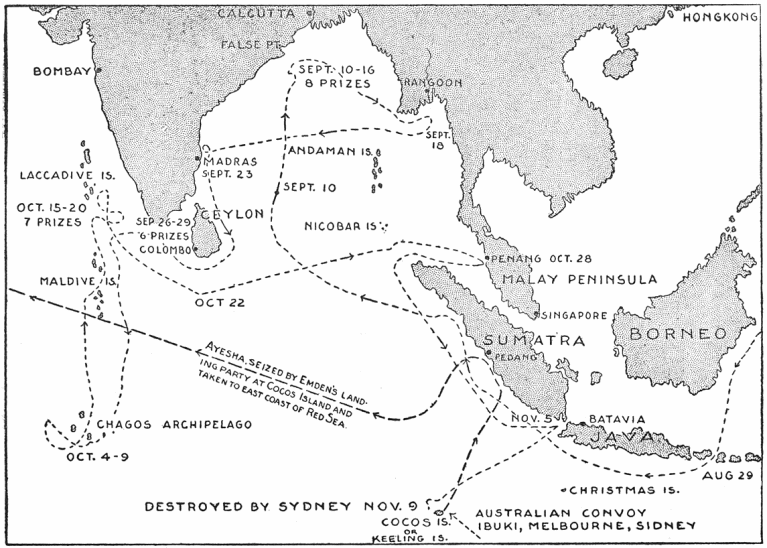

Cruise of the Emden 1914 Map
Map showing the cruise of German raider, light cruiser SMS Emden in the Indian Ocean September - November 1914.
- Date
- 1920
- Mapmaker / publisher
- William Oliver Stevens and Allan Westcott. Published by George H Doran Company, New York
- Place
- voyages
- Archive
- Wikimedia Commons
- Type
- map
- Original size
- 767 × 548 pixels
Public domain
Reason: a US government work.
This status rests on the map's publication history, as researched by Wikimedia Commons. Check it before commercial use.
Read from: Commons licence category: PD US; no CC BY, CC BY-SA, GFDL or deletion tag on the file page.
Credit line
"Cruise of the Emden 1914 Map" (1920). William Oliver Stevens and Allan Westcott. Published by George H Doran Company, New York, via Wikimedia Commons. Public domain. https://commons.wikimedia.org/wiki/File:Cruise_of_the_Emden_1914_Map.pngNeed maps for a whole project? Add Find Any Map to Claude and ask for this one by its id: 23036.
More like this

Battle of the Falkland Islands (1914) Map
1920 · Wikimedia Commons

Three Voyages of a Naturalist: Being an Account of Many Little-Known Islands in Three Oceans Visited by the 'Valhalla' R. Y, S.
1908 · Wikimedia Commons

Battle of Heligoland Bight (1914) First Phase Map
1920 · Wikimedia Commons
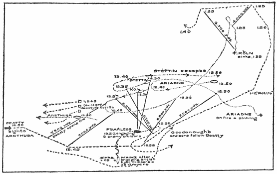
Battle of Heligoland Bight (1914) Final Phase Map
1920 · Wikimedia Commons

Battle of Dogger Bank (1915) Map
1920 · Wikimedia Commons

Gernan East Africa, 1914-1918
1914 · Wikimedia Commons

Map of the Deutsche Ost-Afrika Linie Handbook, 1909
1909 · Wikimedia Commons

Percy Sladen Trust expedition 1905 magnetic variation transactionsofli214linn 0024
December 31, 1912 · Wikimedia Commons