
Cork Harbour RMG K0967
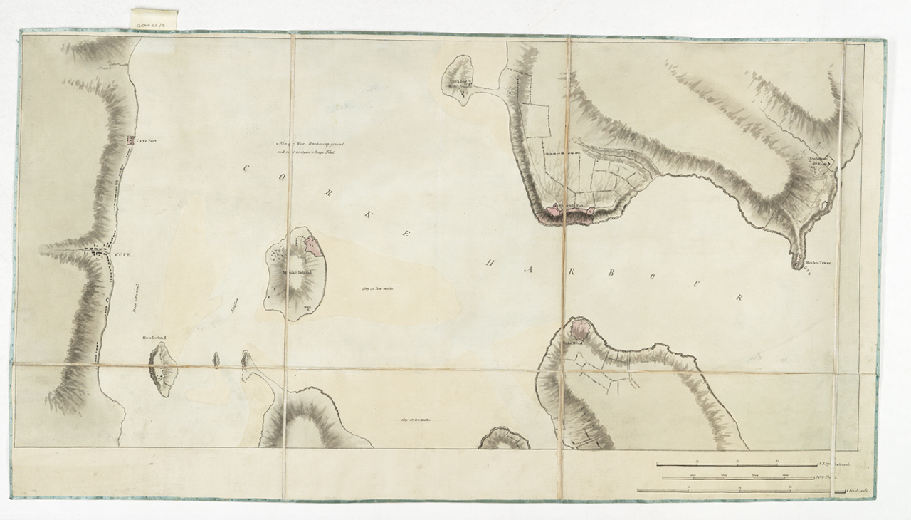
Cork Harbour Single sheet, manuscript. Segmented and backed. Scale: 1:12,000. North at 270 degrees. The chart marks areas which dry at low water. The scale is in English miles, Irish miles, and feet. Additional Places: Cobh, Ireland. There is a note to the effect that the Men of War anchoring ground will not contain a large fleet. Gren2C/5 Cork Harbour
- Date
- 1780
- Place
- Ireland
- Archive
- Wikimedia Commons
- Type
- chart
- Original size
- 1,280 × 730 pixels
Public domainsafest
Reason: its maker died more than 100 years ago.
Read from: Commons licence category: PD-old-100-expired; no CC BY, CC BY-SA, GFDL or deletion tag on the file page.
Credit line
"Cork Harbour RMG K0967" (1780). Wikimedia Commons. Public domain. https://commons.wikimedia.org/wiki/File:Cork_Harbour_RMG_K0967.jpgNeed maps for a whole project? Add Find Any Map to Claude and ask for this one by its id: 243916.
More like this

Admiralty Chart No 1773 Ireland south coast, the port of Cork surveyed by Commr. James Wolfe and Lieut. W.H. Church R.N. 1843 RMG F0502, Published 1846
1846 · Wikimedia Commons

The Island of Guernsey RMG F2027
1680 · Wikimedia Commons

Sea chart of the north coast of Ireland RMG F2034
c. 1600 · Wikimedia Commons

The Harbour of Corke.
1702 · New York Public Library

Sketch of the works erected by the French on Richmond Hill Grenada. J.Brown Lt 27th Regt. RMG K1125
1783 · Wikimedia Commons

Central Ireland, Dublin to Sligo RMG F2040
c. 1600 · Wikimedia Commons

Boston Bay RMG K0732
1776 · Wikimedia Commons

Chart of part of the coasts of Cutch and Guzarat by J G Richardson - communicated by Capt Archibald Blair to whom this plate is inscribed by his most obliged A Dalrymple. Harmar Script RMG L4266
1803 · Wikimedia Commons