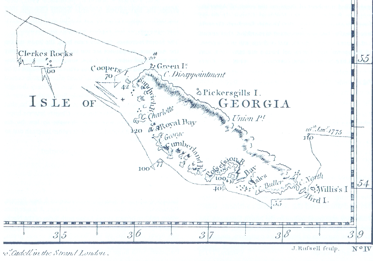

Cook-1777
- Date
- 1777
- Place
- South Georgia
- Archive
- Wikimedia Commons
- Type
- map
- Original size
- 1,269 × 888 pixels
Public domain
Reason: its maker died long enough ago that the copyright has expired.
This status rests on the map's publication history, as researched by Wikimedia Commons. Check it before commercial use.
Read from: Commons licence category: PD Old; no CC BY, CC BY-SA, GFDL or deletion tag on the file page.
Credit line
"Cook-1777" (1777). Wikimedia Commons. Public domain. https://commons.wikimedia.org/wiki/File:Cook-1777.jpgNeed maps for a whole project? Add Find Any Map to Claude and ask for this one by its id: 307053.
More like this

James Cook, Chart of the Discoveries made in the South Atlantic Ocean, in His Majestys Ship Resolution, under the Command of Captain Cook, in January 1775, W. Strahan and T. Cadel, London, 1777. (Sout
1777 · Wikimedia Commons

Capt. Isaac Pendleton, South Georgia; Southatlantic Ocean: Discovered by the Frenchman La Roche in the year 1675, 1802, reproduced by A. Faustini, Rome, 1906
1802 · Wikimedia Commons

Map of South Georgia 1881
1881 · Wikimedia Commons

Pendleton-1802
1802 · Wikimedia Commons

James Cook - A Chart of the Southern Hemisphere
1776 · Wikimedia Commons

A chart of the southern hemisphere; shewing the tracks of some of the most distinguished navigators, by Captain James Cook, of His Majesty's Navy RMG S0021
1777 · Wikimedia Commons

Jassaud map kerguelen expedition 1771 1772
1771 · Wikimedia Commons

South Seas accountofvoyages01hawk 0017
December 31, 1773 · Wikimedia Commons